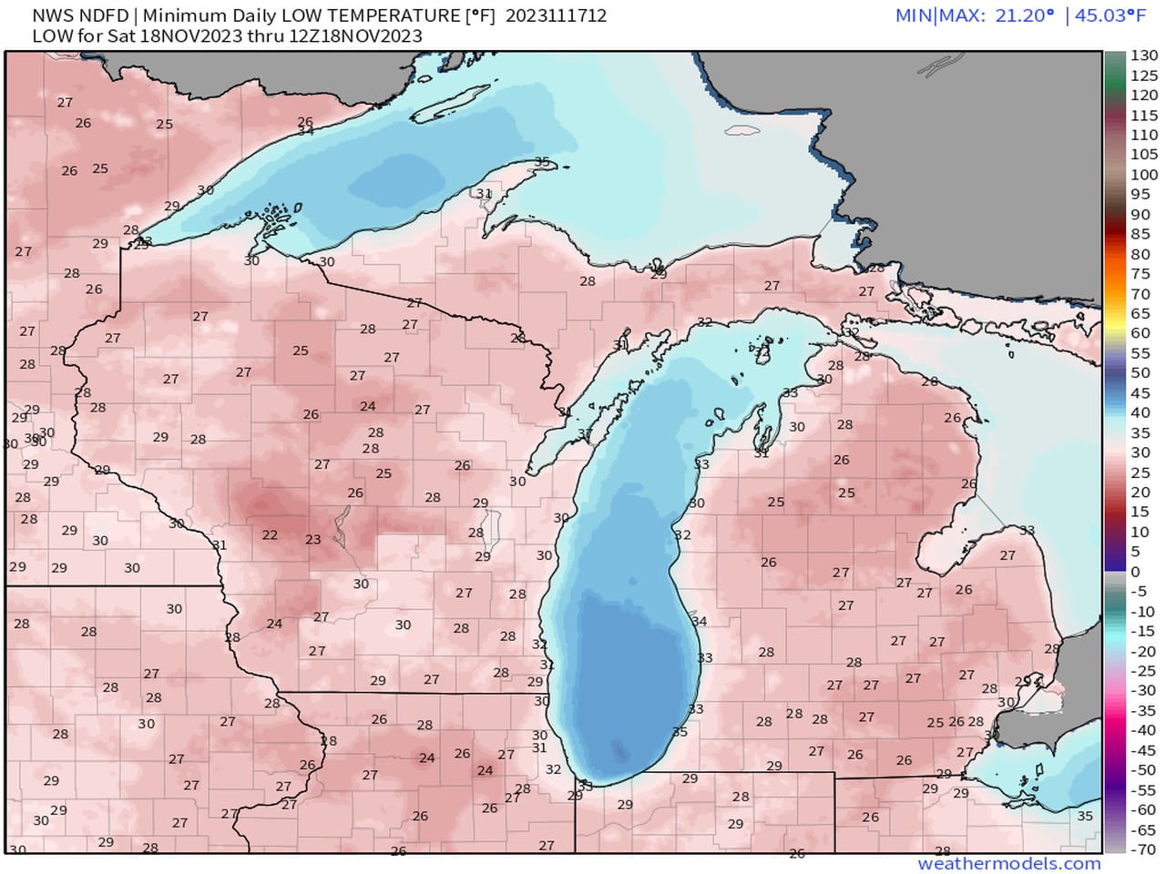
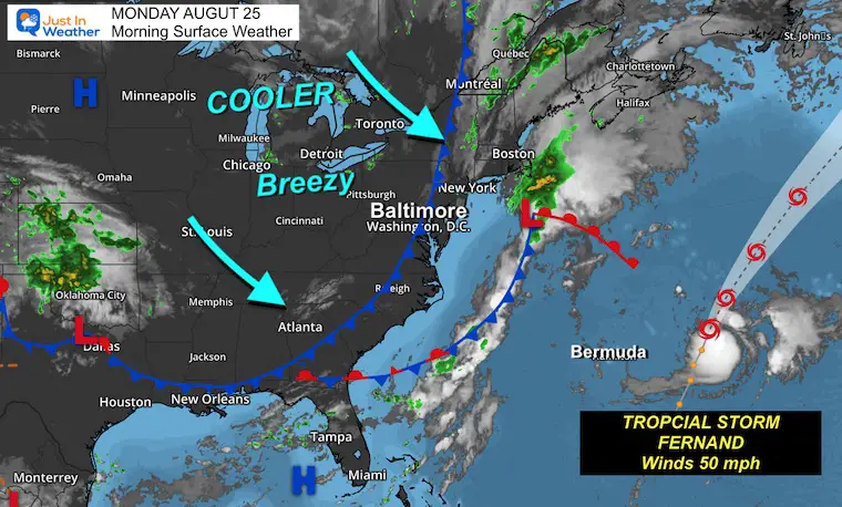
A cold front has moved through, bringing cooler, less humid air and gusty northwest winds, while Tropical Storm Fernand remains offshore and poses no land threat. The week will be dominated by this cooler pattern, with a potential rocket launch visible tonight under clear skies, and temperatures around 10 degrees below average.
Michigan will experience cooler temperatures this weekend, with mornings dropping several degrees below freezing and afternoons being cool by mid-November standards. There won't be any storm systems, so the state should remain dry. Winds will be relatively calm, with a stiff breeze on Saturday and lighter winds on Sunday. However, a major weather pattern change is expected next Wednesday, so it's advised to prepare for winter.
The weekend weather forecast for Baltimore indicates the possibility of rain, with showers becoming more widespread and steady on Friday evening. The rain may continue into Saturday morning, but is expected to taper off in the afternoon, although scattered showers may still be present. Sunday will be dry but chilly with gusty winds, while Monday morning may see colder air and the potential for patchy frost.