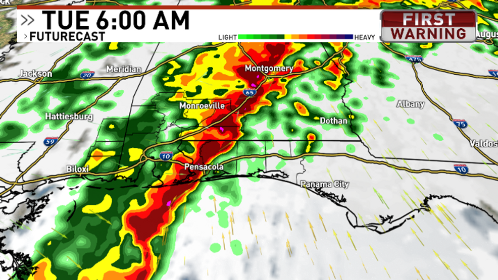
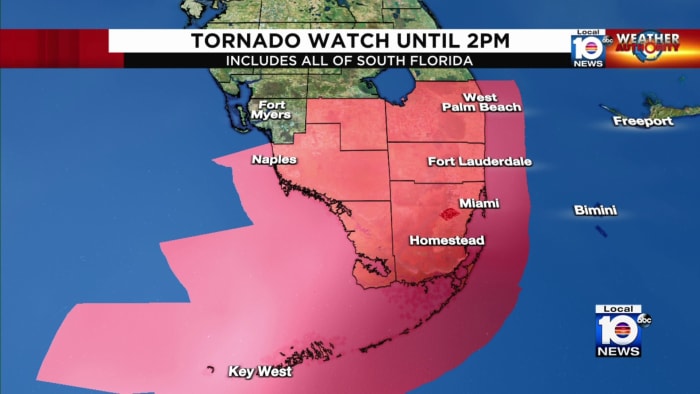
A line of heavy rain and isolated severe thunderstorms is moving through South Florida, with a tornado risk in some areas of Miami-Dade. The National Weather Center warned of damaging wind gusts and isolated tornadoes. The weather conditions are expected to improve in Miami-Dade and Broward counties around 3 p.m. Cooler temperatures are forecast for Monday, with the possibility of scattered showers and isolated thunderstorms in South Florida.
A level 2 severe weather risk is forecast for Monday night through Tuesday morning, with potential for damaging wind gusts, tornadoes, and isolated flash flooding in Northwest Florida. Winds are expected to reach 20-40 mph with gusts up to 50 mph, leading to rough surf, coastal erosion, and a high rip current risk. A Gale Watch is in effect for boaters. Conditions will improve post-Tuesday with a cold front bringing cooler, dry weather and highs in the 50s and 60s.
Central Florida is bracing for an Impact Day on Saturday due to a cold front bringing heavy rain and the potential for strong to severe storms, including wind gusts and an isolated tornado. The severe weather is expected to start in the morning and clear by the evening. The Walt Disney World Half Marathon has been modified due to the forecasted conditions. Cooler temperatures will follow the front, with a dip into the 60s and a calmer Sunday expected. However, another severe weather threat may arise by Tuesday. Residents are advised to stay updated with local weather alerts.