"Florida Braces for Multi-Day Severe Weather, Including Tornado Threat and Storm Surges"
TL;DR Summary
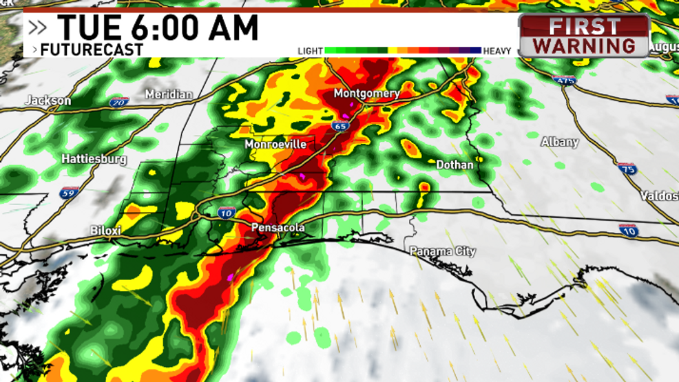
A level 2 severe weather risk is forecast for Monday night through Tuesday morning, with potential for damaging wind gusts, tornadoes, and isolated flash flooding in Northwest Florida. Winds are expected to reach 20-40 mph with gusts up to 50 mph, leading to rough surf, coastal erosion, and a high rip current risk. A Gale Watch is in effect for boaters. Conditions will improve post-Tuesday with a cold front bringing cooler, dry weather and highs in the 50s and 60s.
- Severe weather possible Monday Night - Tuesday Morning WEAR
- Showers linger Sunday Wink News
- Tallahassee, Florida severe weather threat: Tornadoes, rain, wind gusts Tallahassee Democrat
- Tuesday storm threat: Breaking down what to expect in Tampa Bay WTSP.com
- Miami and Florida forecasters predict arrival time of storms Miami Herald
Reading Insights
Total Reads
0
Unique Readers
9
Time Saved
1 min
vs 2 min read
Condensed
68%
253 → 80 words
Want the full story? Read the original article
Read on WEAR