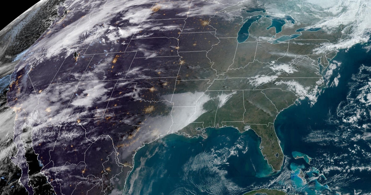
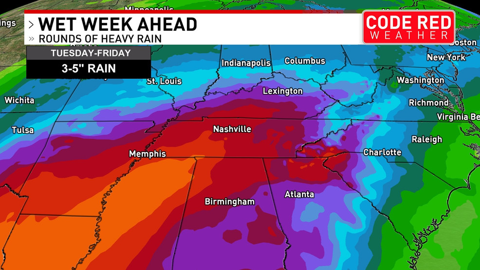
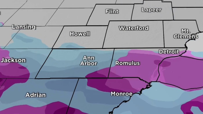
Wild temperature fluctuations are hitting the US this week, with 78 cities hitting record highs on Monday before experiencing severe storms, snow, and freezing temperatures. International Falls, Minnesota, hit a record high of 53°F on Monday but is expecting a low of -9°F on Wednesday with 7 to 11 inches of snow. Lack of snow in Wisconsin and Maine has led to trail closures and event cancellations, while Texas saw record highs with Laredo hitting 36°C. Meteorological seasons differ from astronomical seasons, with meteorologists using March 1 as the start of spring for consistency.
February has seen above-average temperatures and little snow, with record warmth expected for Tuesday and Wednesday before a brief blast of colder air moves in late Wednesday through Thursday evening. This will bring a risk of regular and lake effect snow, with the potential for a flash freeze on Wednesday night. Gusty winds are also expected. Temperatures should rebound above average from Friday afternoon through next weekend.
The contiguous United States is set to experience extreme weather this week, with over 100 record highs expected as temperatures soar to summer-like levels. A sharp cold front will bring a dramatic drop in temperatures by midweek, accompanied by a February storm moving across the country, leading to severe thunderstorms, heavy rainfall, and a rare tornado risk in the Midwest. Winter storm warnings are in place for the West, with heavy snow and gusty winds expected, while the East Coast will see heavy rain and strong winds.
Middle Tennessee and Southern Kentucky are expected to experience a big thaw and heavy rain this week, with temperatures starting in the teens on Monday and climbing to the mid 60s by Thursday. The region could see 3 to 5 inches of rain, leading to flooding concerns due to snow melt. A brief break in the rain is expected on Friday, with more rain in the forecast for the weekend.
Extremely cold and windy weekend with temperatures barely rising into the low 30s on Saturday and slightly warmer near 40 degrees on Sunday, followed by a rainy and warmer week with daytime highs reaching near 70s by the middle of next week. The rain could start as early as Tuesday and continue through Friday, with 1-3 inches of rain possible throughout the week. Overnight lows will increase by about 30 degrees from Saturday to next Thursday, and daytime highs will be 20-30 degrees warmer by Thursday.
Metro Detroit is expected to experience sprinkles or a chance of snow overnight, with temperatures hovering around freezing. The type of weather will vary depending on location, with areas closer to the Ohio border more likely to see a coating of snow. North of I-94, a mix of rain and light snow is expected. Temperatures will start to climb after tomorrow, reaching the 50s by the end of the week.
November in Washington, D.C. is expected to be cool and dry with fluctuating temperatures. The average temperature is projected to range from 47 to 49 degrees, slightly below the recent average. Rainfall is forecasted to be 1.5 to 2.5 inches, below the November norm of 2.91 inches. While November typically sees some snow, measurable snowfall is not expected this month. Computer models indicate slightly cooler and drier conditions for the first two weeks, with mixed signals for the second half. The El Niño pattern, which usually brings more precipitation, has not yet emerged. October was drier than normal, with only 0.65 inches of rain, and the third-warmest year on record continues in Washington, D.C.