Tag

Satelliteimaging

All articles tagged with #satelliteimaging

"AI and Satellite Data Uncover the Hidden Congestion of 'Dark Vessels' in Global Seas"
environment-and-science2 years ago

"AI and Satellite Data Uncover the Hidden Congestion of 'Dark Vessels' in Global Seas"

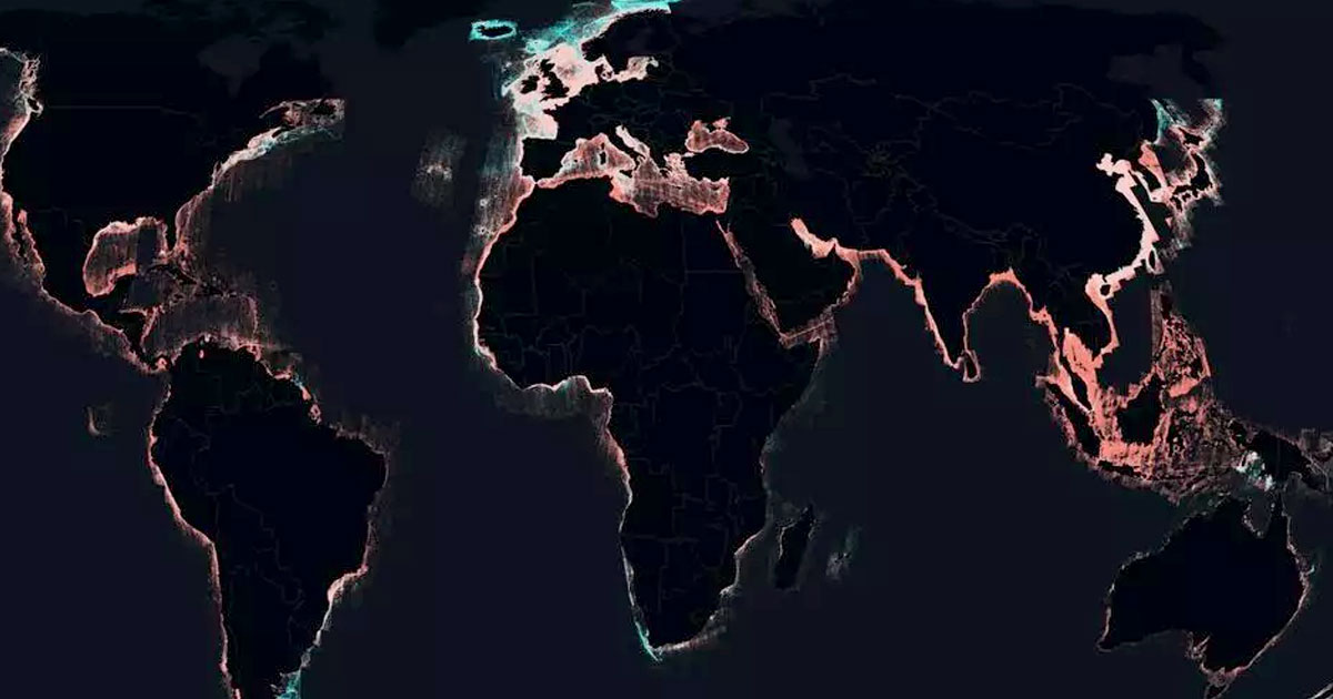
A study by Global Fishing Watch, supported by Google, has revealed that a significant portion of the world's industrial fishing vessels, as well as transport and energy vessels, are not being tracked publicly. Using AI to analyze satellite data, researchers found that 72 to 76 percent of fishing vessels and nearly a third of other vessel activities are "dark," meaning they are not visible to public tracking systems. This research, which also noted a substantial increase in offshore wind turbine installations, aims to provide policymakers with comprehensive data to address maritime activity's impact on the climate crisis.

"Scientists Discover Hidden Lagoons and Ancient Life Forms in Argentina's 'Forgotten' Land"
science-and-environment2 years ago

"Scientists Discover Hidden Lagoons and Ancient Life Forms in Argentina's 'Forgotten' Land"

Scientists investigating satellite images of Argentina's Puna de Atacama desert discovered unusual green and blue spots, leading to the discovery of lagoons with stromatolite communities resembling ancient life forms over 3.5 billion years old. These formations are under threat due to a mining lease in the area, prompting a race to study and potentially protect this unique ecosystem before it's disturbed.