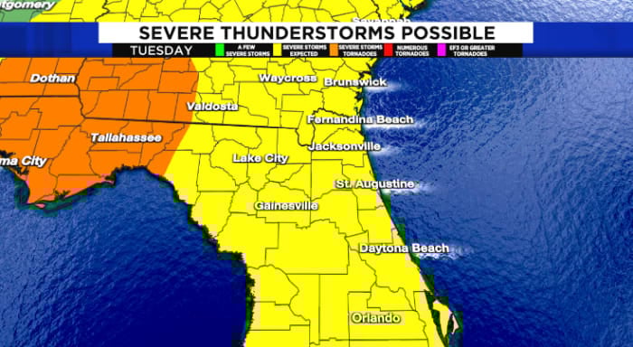
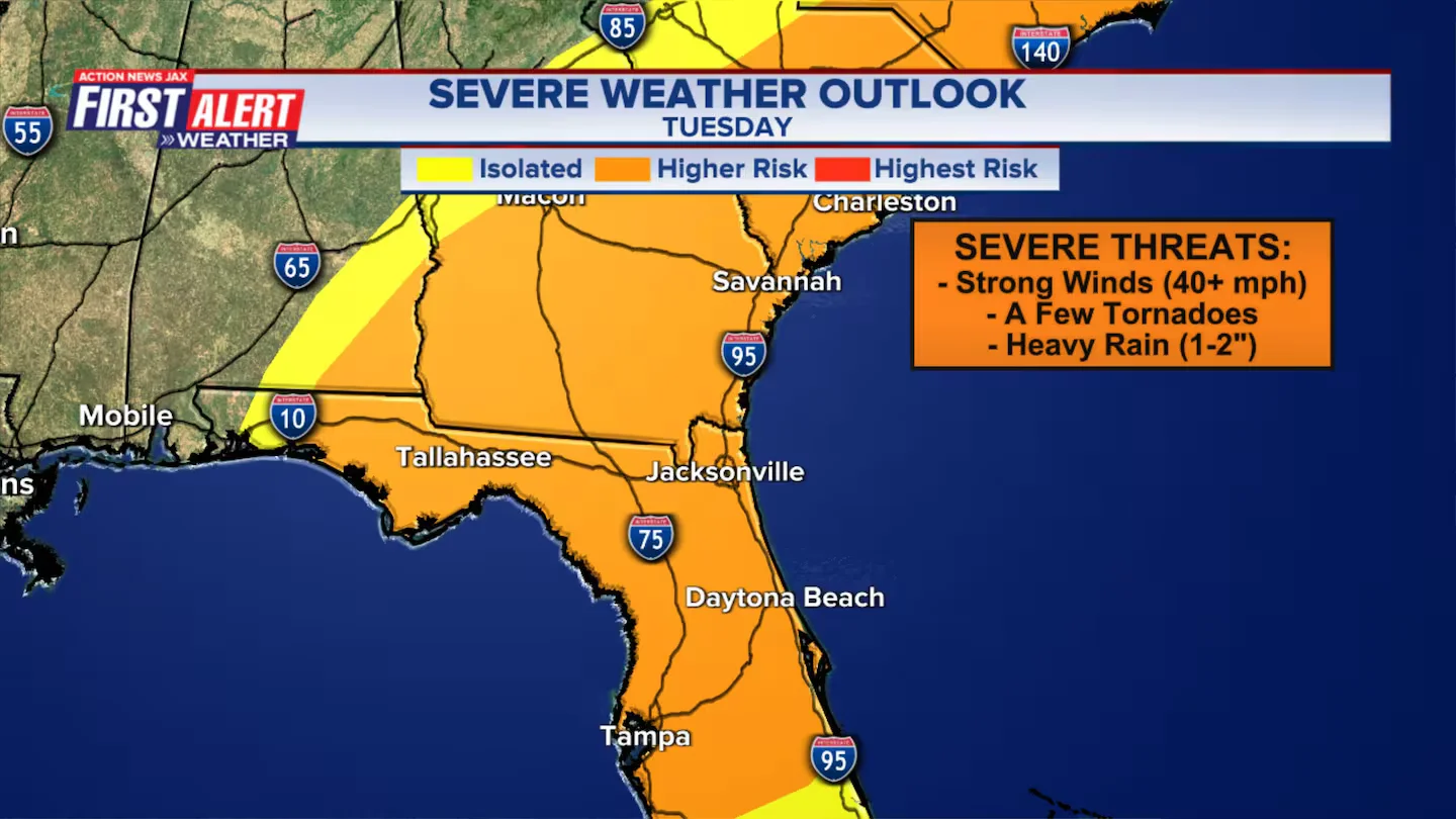
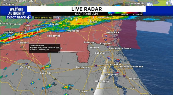
A Tornado Watch is in effect for several counties in Florida and Georgia until 4 p.m. Severe storms with damaging wind, hail, and tornadoes are expected mainly north of I-10 and across southeast Georgia. Rain and thunderstorms are forecasted for the region, with clearing and cooler temperatures expected on Sunday.
Severe weather, including heavy downpours, tornadoes, and small hail, has led to closures of government offices and other facilities in Northeast Florida and Southeast Georgia. All 11 Northeast Florida counties are under a state of emergency, with closures and service updates announced for various counties, including Duval, St. Johns, Clay, and Alachua. Residents are advised to stay off the roads until the storm passes, and specific closures and cancellations are detailed for each county.
Northeast Florida and Southeast Georgia are facing an enhanced threat for severe weather on Tuesday, with damaging winds, isolated tornadoes, and heavy downpours expected between noon and 7 p.m. School districts have canceled classes in anticipation of the severe storms, and residents are advised to secure outdoor items, as tree damage and power outages are possible. The main threat areas are the St. Johns River Basin around Downtown Jacksonville and coastal SE Georgia, with minor coastal/tidal flooding expected. Widespread rainfall flooding is not anticipated, but localized flooding is possible. Residents are urged to stay updated on the evolving weather conditions and to download the News4JAX Weather apps for the latest alerts.
Several counties in Northeast Florida and Southeast Georgia, including Duval, Clay, Nassau, and others, are canceling classes on Tuesday due to the threat of severe weather, including high winds, power outages, tornadoes, and possible road closures. The decision to close schools is made in the interest of student and staff safety, with some districts also canceling after-school activities and postponing meetings. The National Weather Service warns of isolated strong-to-severe storms bringing heavy downpours, tornadoes, and small hail from noon to sunset on Tuesday.
A strong storm system and cold front will bring widespread severe weather to much of the U.S. east of the Rockies, including Northeast Florida and Southeast Georgia. Locally, windy conditions are expected with the potential for damaging winds, isolated tornadoes, hail, and heavy rain in the afternoon. Gusty winds will continue into Tuesday night, and there is a possibility of isolated severe storms ahead of the main line. This storm will also produce a snowstorm for the Midwest and flooding along the East Coast and Northeast U.S., making it the biggest and strongest storm of the winter so far.