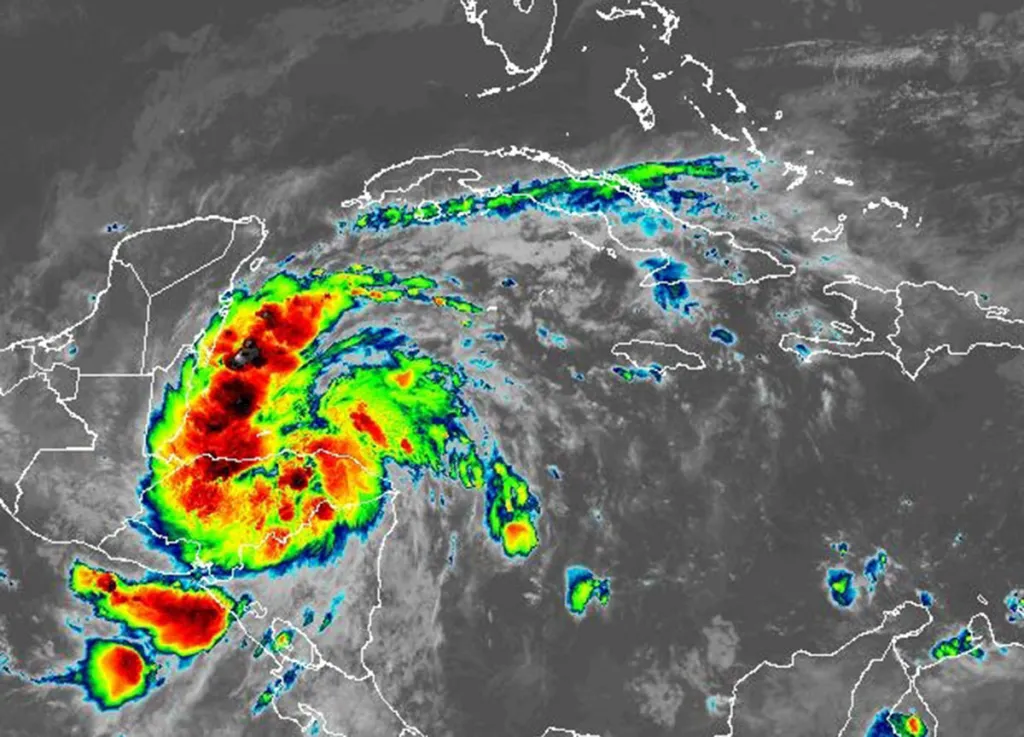
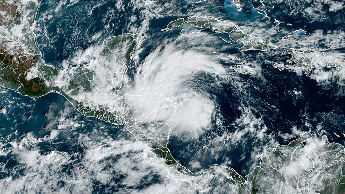
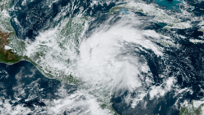
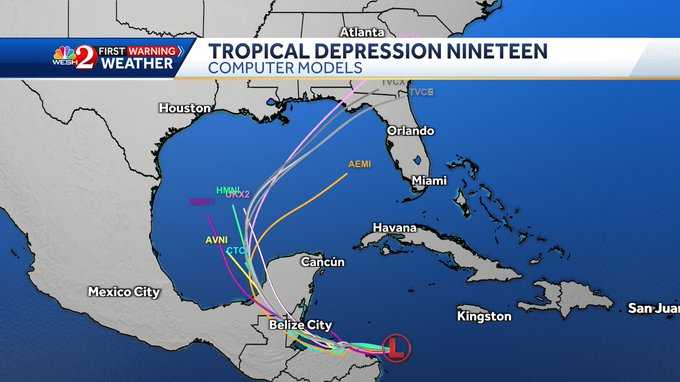
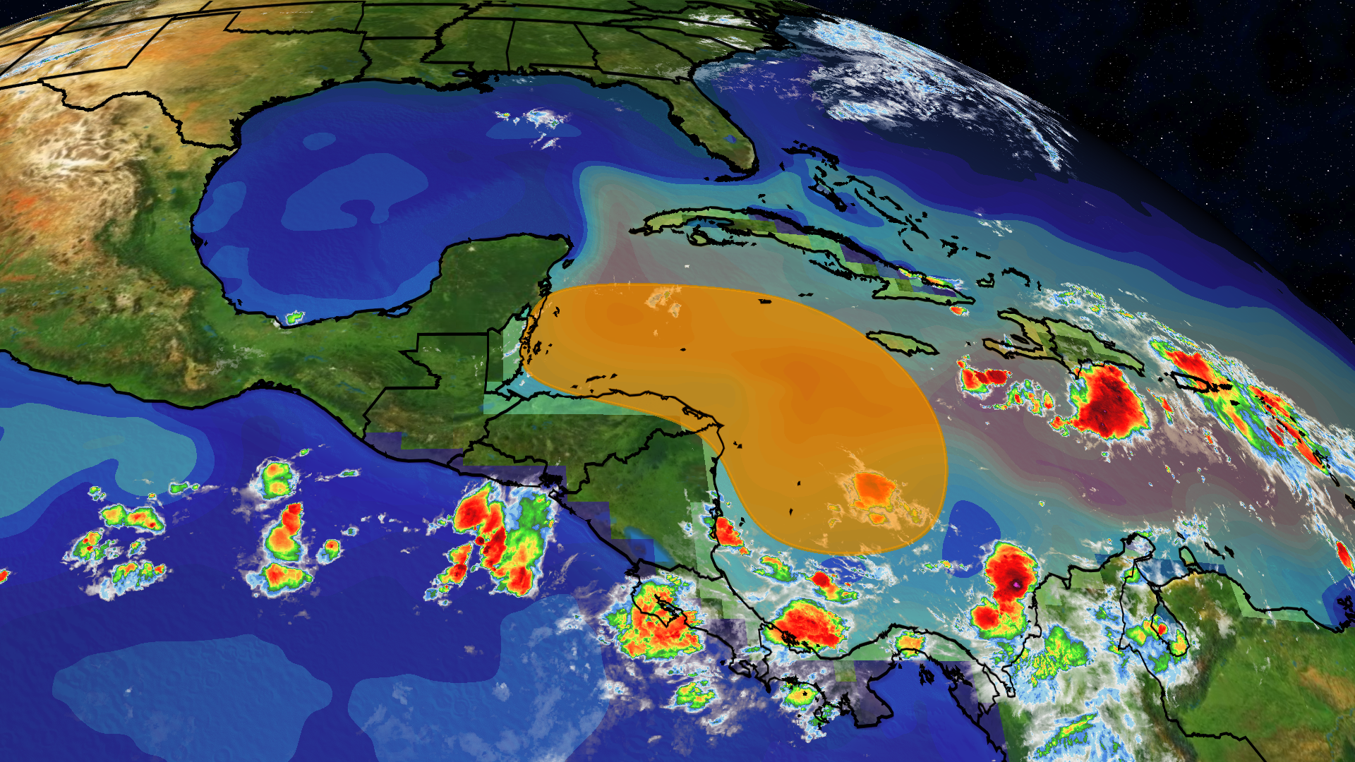
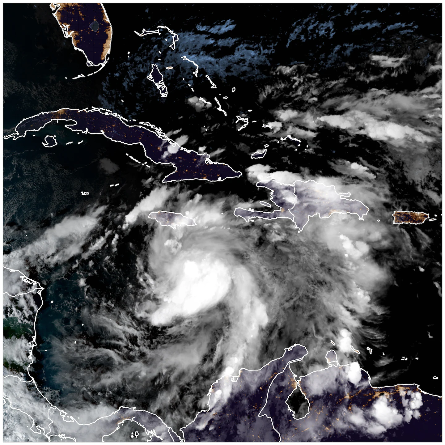
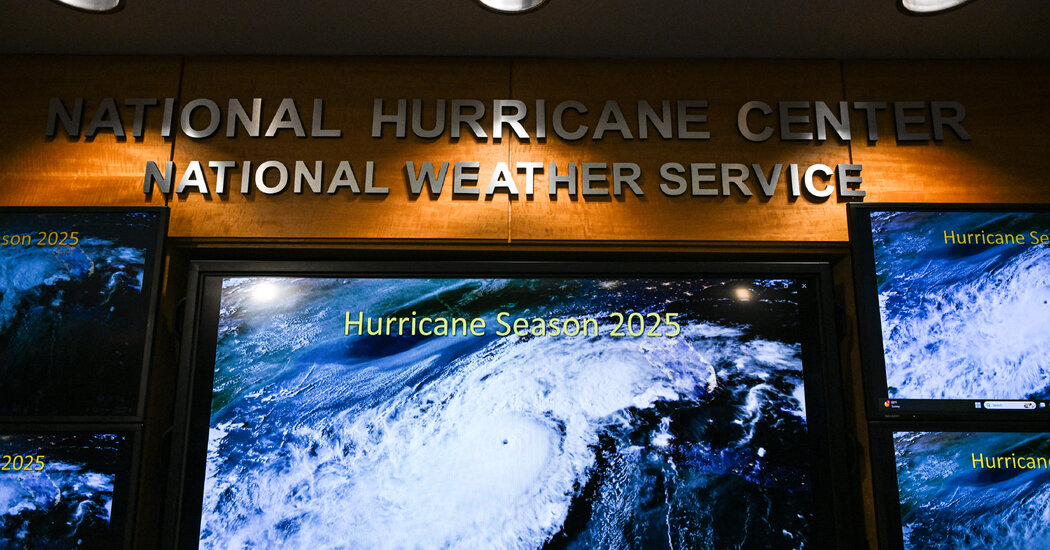
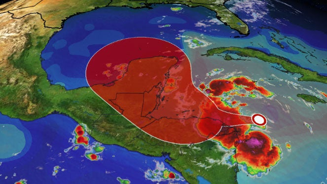
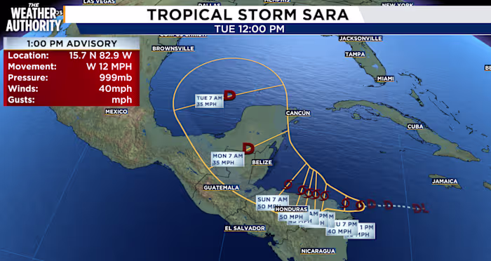
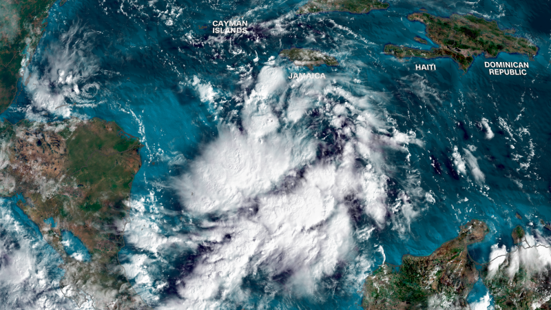
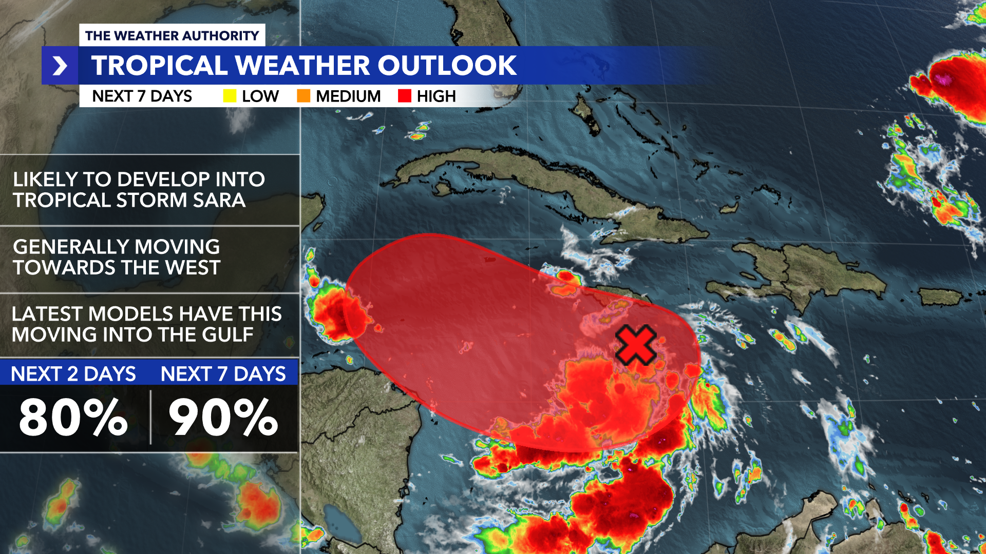
The Atlantic hurricane season, initially predicted to be quiet, is showing signs of increased activity with forecasts now expecting up to nine hurricanes before November, driven by changing weather patterns and warmer ocean temperatures, signaling a potentially more active period ahead.
The 2024 Atlantic hurricane season ended with unexpected patterns, featuring early activity and strong late storms, but a quiet peak period. Researchers are examining factors like ocean temperatures and climate patterns such as La Niña and the Madden Julian oscillation to understand these anomalies. Climate change likely intensified storms like Hurricanes Helene and Milton, which caused significant damage. Despite fewer storms than predicted, the season was still extremely active, with climate change contributing to the severity of the hurricanes.
Tropical Storm Sara is expected to weaken as it moves over Central America this weekend, potentially dropping up to 30 inches of rain in northern Honduras and causing flash floods and mudslides. The storm is forecast to lose its tropical status over land but may reemerge as a remnant low in the Gulf of Mexico, possibly affecting Florida with increased rain by midweek. Despite the moisture, conditions are not favorable for redevelopment into a tropical system. This marks the 18th named storm of the 2024 Atlantic hurricane season.
Tropical Storm Sara has formed over the western Caribbean Sea and is expected to bring potentially catastrophic flooding to Central America, including Honduras, Belize, El Salvador, and Guatemala, with up to 30 inches of rain possible. The storm is moving slowly due to high pressure and weak steering currents, which could lead to prolonged flooding. While the storm may enter the Gulf of Mexico, its impact on the U.S. remains uncertain. The hurricane season, which ends on November 30, has been hyperactive, with Sara contributing to high accumulated cyclone energy levels.
Tropical Storm Sara has formed in the Caribbean and is heading towards Central America, posing a significant threat with potentially life-threatening flooding and mudslides, particularly in Honduras and Nicaragua. The storm, the 18th of the 2024 Atlantic hurricane season, is fueled by exceptionally warm waters linked to climate change. While the storm's future path remains uncertain, it could impact the Yucatán Peninsula and possibly the Gulf of Mexico next week. Residents in affected areas are advised to monitor forecasts closely.
Tropical Depression 19 has formed in the Caribbean, with the potential to strengthen into Tropical Storm Sara by the weekend. Currently located 225 miles east-southeast of Isla Guanaja, Honduras, it poses a threat of heavy rainfall and flash flooding in Honduras and Belize. The system is expected to move into the Gulf of Mexico next week, possibly affecting Florida, though wind shear may limit its development. Tropical storm warnings are in effect for parts of Honduras and Nicaragua.
Tropical Depression Nineteen is expected to intensify into Tropical Storm Sara, posing a significant flood threat to Central America with up to 30 inches of rain possible in some areas. The storm's path beyond Central America is uncertain, but it may enter the Gulf of Mexico next week, potentially affecting Florida. Residents in the western Caribbean and Florida are advised to monitor the situation closely.
Tropical Storm Sara has formed in the Caribbean and is expected to bring heavy rain and potential flooding to Central America, particularly Honduras and Nicaragua, over the weekend. The storm is unlikely to impact Florida significantly due to a strong autumn cold front that will steer the storm away, resulting in only a brief period of rain in Florida next Wednesday. The system is not expected to strengthen into a hurricane as it moves into the Gulf of Mexico.
A new tropical system, potentially becoming Tropical Storm Sara, is forming south of Jamaica and could impact the Caribbean, Mexico, and the US. Despite the typical winding down of the Atlantic hurricane season in November, exceptionally warm waters, influenced by climate change, are fueling continued storm activity. The system may strengthen into a tropical storm or hurricane, with scenarios ranging from landfall in Central America to potentially reaching the US Gulf Coast. The Caribbean's sea surface temperatures are near record highs, increasing the risk of strong storms.
The National Hurricane Center warns of a potential late-season tropical storm, possibly named Sara, forming in the Caribbean with a 90% chance of development in the next 48 hours. The storm could head towards Florida's Gulf coast, though its path remains uncertain. This would be a rare occurrence for November, with only three hurricanes making U.S. landfall in this month since 1850. The potential storm follows a series of recent hurricanes impacting Florida, highlighting concerns about climate change's role in increasing hurricane frequency and intensity.
A tropical depression is expected to form in the Caribbean Sea and reach the Gulf of Mexico early next week, with forecasters warning of dangerous winds and seas. The system has a 90% chance of developing in the next two days and could bring heavy rains to Jamaica. If it becomes a named storm, it will be called Sara, marking the 18th named storm of the 2024 Atlantic hurricane season. Meanwhile, remnants of Rafael are merging with a cold front in the Gulf, bringing drier conditions to Louisiana.
A tropical disturbance near Jamaica, designated as Invest 99L by the National Hurricane Center, is likely to develop into Tropical Storm Sara by the end of the week. The system is expected to form near the Honduras-Nicaragua border and could become a hurricane by early next week. Forecast models suggest it may move north, potentially impacting Florida, though its exact path remains uncertain. Residents are advised to stay informed as the situation develops.
The Weather Authority is monitoring Invest 99-L, a tropical wave in the Caribbean with a 90% chance of developing into a tropical depression or Tropical Storm Sara by Thursday or Friday. Cold fronts in Florida will keep the system's moisture south through the weekend, but it is expected to move northwest by early next week, potentially entering the Gulf of Mexico. Heavy rains are forecasted for Jamaica and parts of Haiti. The system's future path and impact on Southwest Florida depend on upcoming cold fronts and wind shear conditions.
The National Hurricane Center is monitoring a potential tropical development in the western Caribbean, which could form into a tropical depression or storm by late this week or weekend. If it develops, it will be named "Sara." November typically sees storms in the Caribbean or Atlantic due to conducive environmental conditions, despite the hurricane season winding down. The exact path and strength of the potential storm remain uncertain.
Tropical Storm Rafael has formed in the Caribbean and is expected to strengthen into a hurricane, impacting Jamaica and the Cayman Islands with heavy rain and strong winds. The storm may intensify further as it moves towards the Gulf of Mexico, although it is likely to weaken due to cooler waters and disruptive winds. Rafael's moisture could bring heavy rain to parts of Florida, Georgia, and South Carolina. This season has been more active than average, with Rafael potentially becoming the 11th hurricane of the season.