A significant snowstorm is forecasted for Colorado's high country, with over a foot of snow expected, raising avalanche risks and impacting travel, as a second storm is anticipated to follow, amid below-average snowpack levels and historically warm December temperatures.
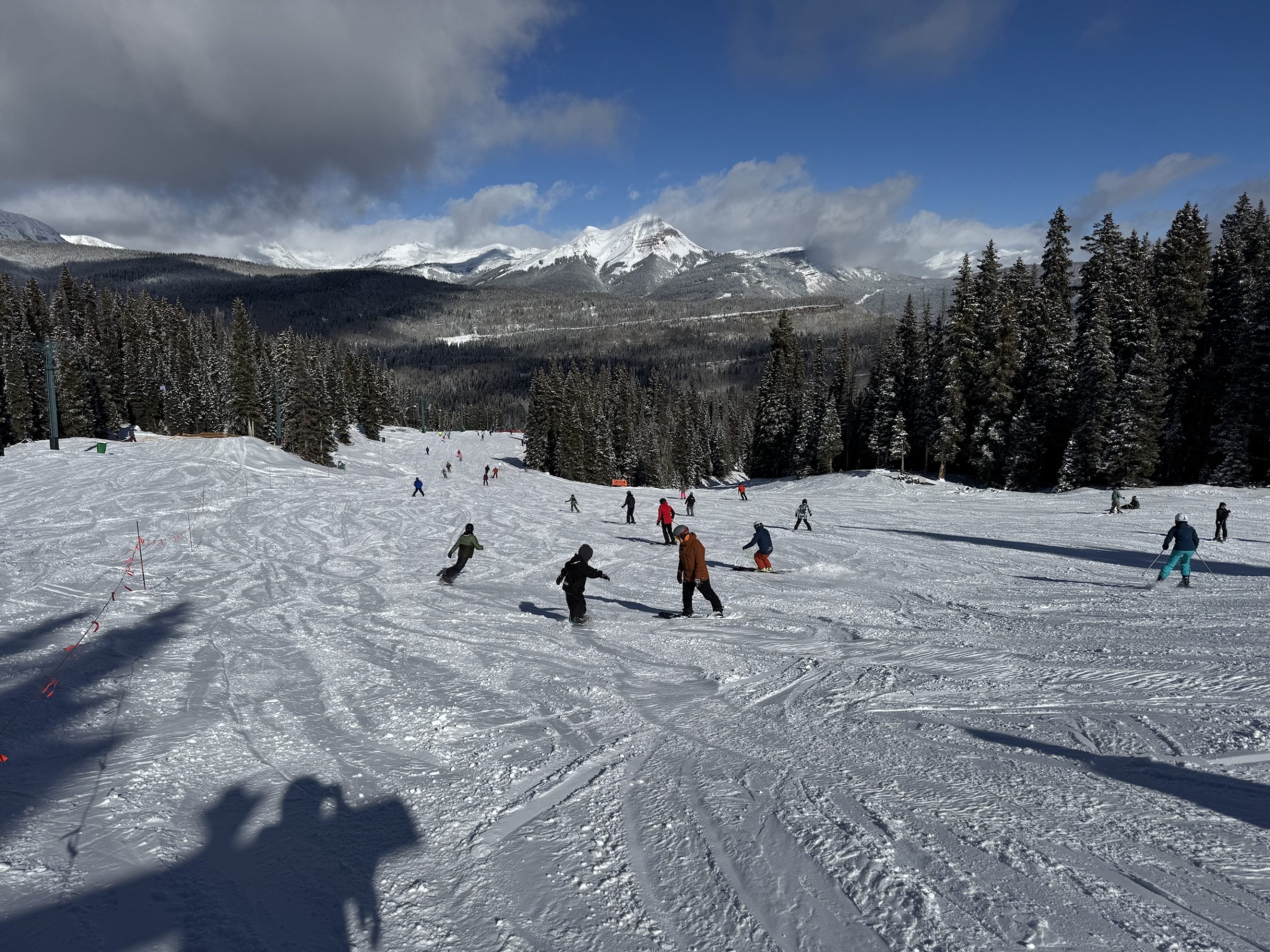
Colorado experienced significant snowfall over the weekend, with the mountains receiving the most accumulation. Steamboat Springs saw 6 inches of snow, while Telluride received 7.5 inches. The National Weather Service issued Winter Storm Warnings and Winter Weather Advisories for various parts of the high country, cautioning about blizzard-like conditions. The list of snow totals includes measurements from different locations, and it will be updated as more snowfall occurs.
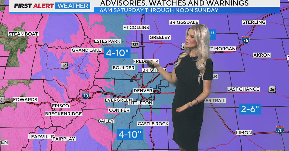
A snowstorm is expected to hit Colorado this weekend, starting with heavy snowfall in the high country and gradually descending to the Front Range. Winter Storm Watches are in place for the Denver area and parts of the foothills, with potential snow accumulations of 4 to 10 inches. Some areas in the Front Range mountains could see up to two feet of snow. Temperatures will drop significantly, with highs only reaching the upper 20s on Saturday and Sunday. The snow is expected to taper off on Sunday afternoon, followed by cold and cloudy conditions.
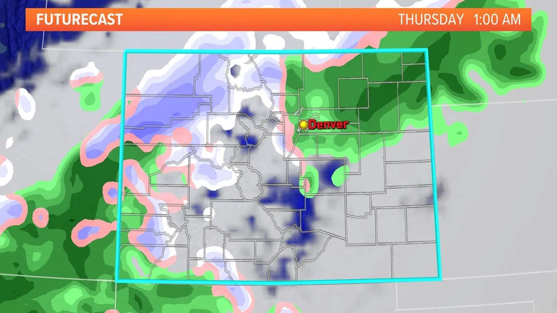
After warm temperatures in the low 70s on Wednesday, Denver will experience a sharp temperature drop with snow and highs in the 30s on Thursday and through the weekend. The snow will start as rain before flipping to wet snow during or just before the Thursday morning commute, with accumulations of an inch or less in Denver and 1 to 3 inches in Boulder, Golden, and the foothills. Meanwhile, the high country could see up to 2 feet of snow with Winter Storm Warnings and Winter Weather Advisories in effect. Travel could be difficult in the mountains on Wednesday afternoon and night. Chances for significant snow return for southeastern Colorado on Saturday night, Sunday, and Monday.