Massachusetts braces for icy mix, plowable snow and southeastern flooding risk
TL;DR Summary
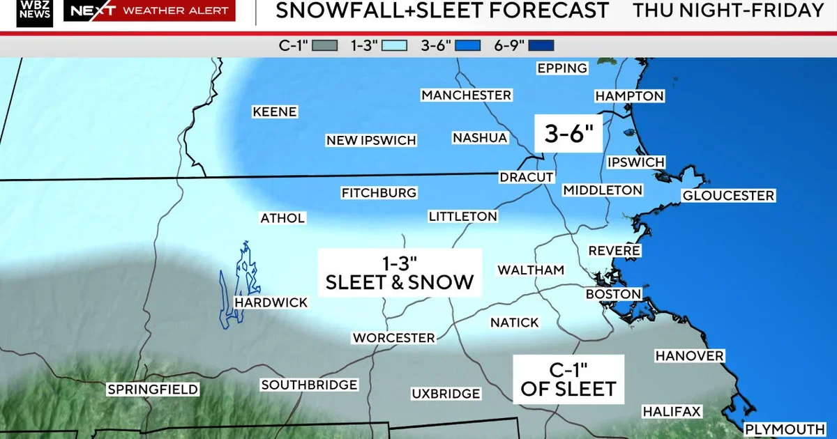
A wintry mix is expected Thursday night into Friday across Massachusetts, with ice accretion in western areas (up to about 0.25 inches) and snow in Essex County; localized 3–6 inches of snow possible in parts of northeastern MA and southeastern NH, while northern Worcester and the Boston metro may see 1–3 inches of wet snow/sleet. Southeastern MA could see heavy rain and localized flooding. The worst travel impacts are from 9 p.m. Thursday to 9 a.m. Friday, with conditions improving Friday and a much warmer weekend on the way.
- Significant icing, plowable snow possible in parts of Massachusetts starting Thursday night, weather maps show CBS News
- Another messy storm moves into New England on Thursday afternoon The Boston Globe
- FIRST ALERT: Rain, sleet & snow mix will make for tricky travel later today into Friday NBC Boston
- Snow, Ice and Rain WHDH
- Forecast: More sloppy weather to create a slick evening and morning commute WBUR
Reading Insights
Total Reads
1
Unique Readers
1
Time Saved
3 min
vs 4 min read
Condensed
87%
687 → 89 words
Want the full story? Read the original article
Read on CBS News