Boston Braces for Potential Blizzard: 10–16 Inches and 70 mph Winds Loom
TL;DR Summary
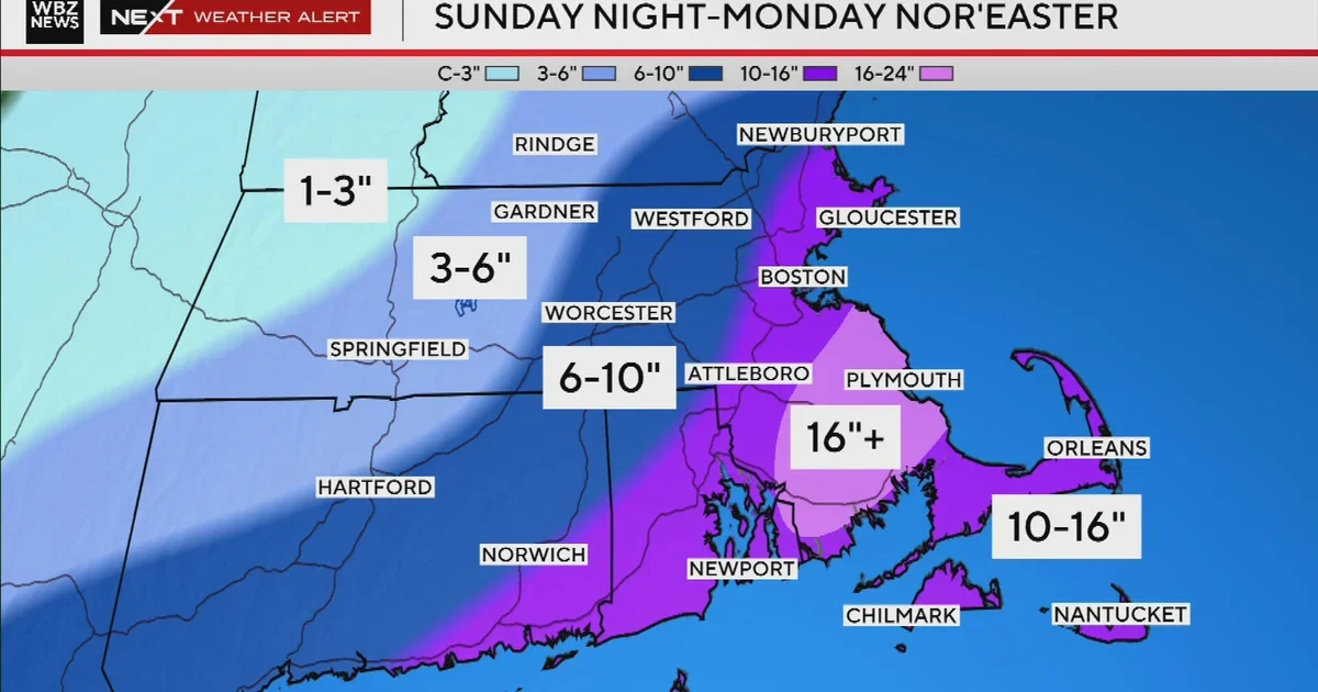
A major nor'easter could bring blizzard conditions to Boston Monday, with 10–16 inches of snow across eastern Massachusetts and heavier bands along the coast; winds of 55–70 mph could cause power outages and roof damage, especially near the shore and Cape Cod. The storm is expected to bombogenesis as it moves north-northeast from the South, with snow starting Sunday evening and peaking Monday morning through the afternoon before tapering. A jackpot zone around Plymouth and Bristol counties could push totals over 16 inches, and coastal flooding is possible during Monday afternoon and Tuesday morning high tides.
- Potential blizzard in Boston could drop a foot of snow or more Monday, weather forecast maps show CBS News
- Storm maps show where rain, sleet, and snow will hit Friday The Boston Globe
- Nor'easter to likely hit Massachusetts with 'blizzard-like' conditions: Which spots will be hardest hit? Boston Herald
- Snow forecasted for Friday night; totals rising for Monday's storm WCVB
- New snowfall map: Weekend nor'easter could bring a foot or more to parts of Mass. NBC Boston
Reading Insights
Total Reads
1
Unique Readers
1
Time Saved
4 min
vs 5 min read
Condensed
88%
812 → 96 words
Want the full story? Read the original article
Read on CBS News