"Hurricane Otis: From Tropical Storm to Nightmare Scenario in a Single Night"
TL;DR Summary
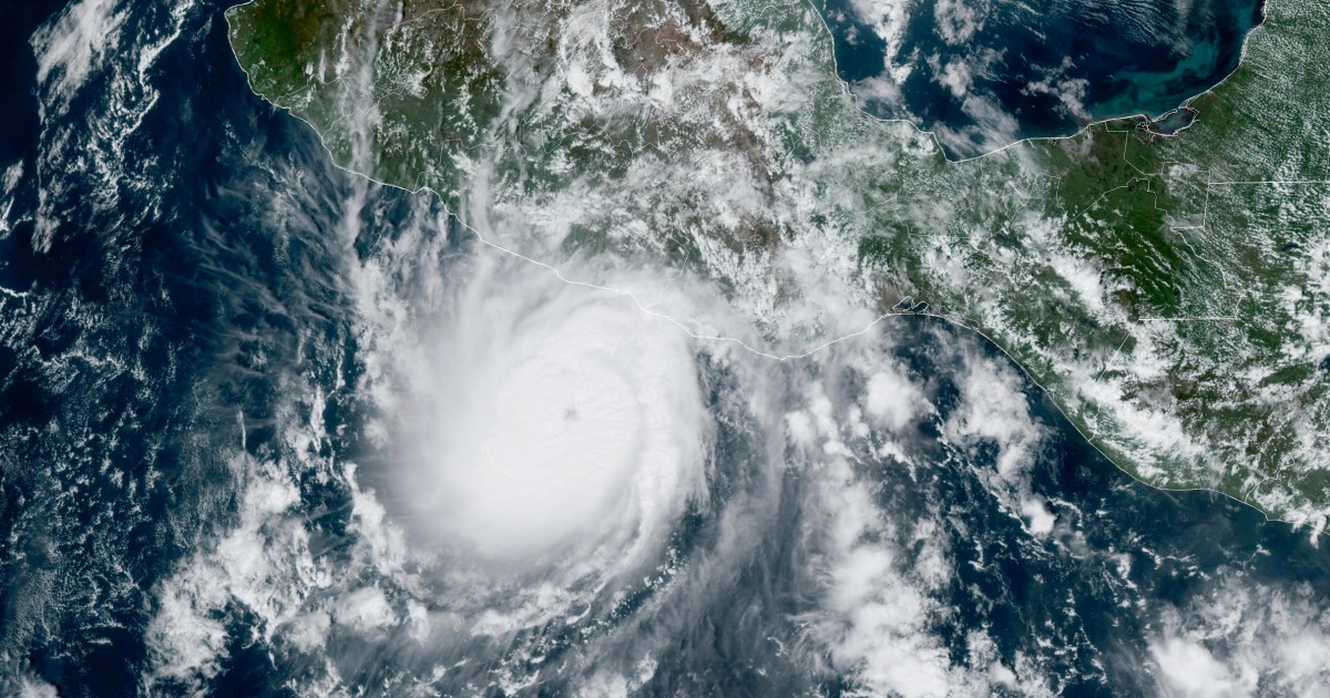
Hurricane Otis rapidly intensified from a tropical storm to a Category 5 hurricane in just 24 hours, causing a "nightmare scenario" for southern Mexico. This trend of rapid intensification in tropical storms approaching landfall has been observed in recent years, potentially influenced by climate change and advancements in satellite technology. The increased intensity makes forecasting more challenging, posing risks of life-threatening storm surge, destructive winds, heavy precipitation, mudslides, and flash floods.
Topics:top-news#climate-change#forecasting-challenges#hurricane-otis#natural-disasters#rapid-intensification#southern-mexico
- Hurricane Otis: How a tropical storm turned into a 'nightmare scenario' overnight NBC News
- Category 5 Hurricane Otis heading toward Acapulco, Mexico: 'Nightmare scenario' KCRA 3
- Near record highs continue - Baton Rouge WAFB
- Hurricane Otis unleashes a ‘nightmare scenario’ Category 5 strike on Acapulco and southern Mexico CNN
- RAW: HURRICANE OTIS PRESENTS 'NIGHTMARE SCENARIO' | National and World News | channel3000.com Channel3000.com - WISC-TV3
Reading Insights
Total Reads
0
Unique Readers
1
Time Saved
2 min
vs 2 min read
Condensed
82%
399 → 71 words
Want the full story? Read the original article
Read on NBC News