"Satellite Images Capture Russia's Tallest Volcano's Massive Smoke River After Eruption"
TL;DR Summary
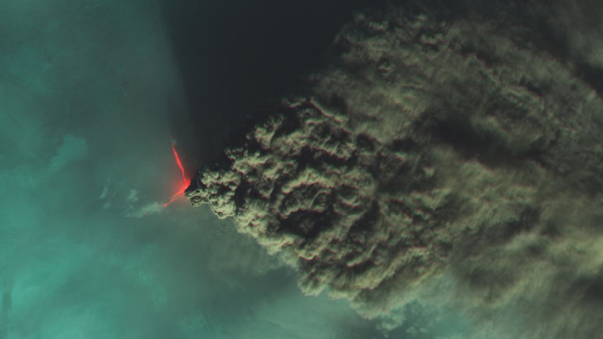
Russia's tallest volcano, Klyuchevskoy, erupted violently, spewing a 1,000-mile-long cloud of dust and ash into the air. The eruption reached a maximum height of 7.5 miles above Earth's surface and prompted the grounding of planes and evacuation of schools due to increased air pollution. Satellite images captured the massive plume, which eventually stretched up to 1,400 miles long. Although the eruption only lasted a few days, it had no significant impact on the ozone layer. The Kamchatka Peninsula, where the volcano is located, is part of the Pacific Ring of Fire.
Reading Insights
Total Reads
0
Unique Readers
8
Time Saved
3 min
vs 4 min read
Condensed
86%
655 → 91 words
Want the full story? Read the original article
Read on Livescience.com