Winter weather persists with potential for more snow and strong winds.
TL;DR Summary
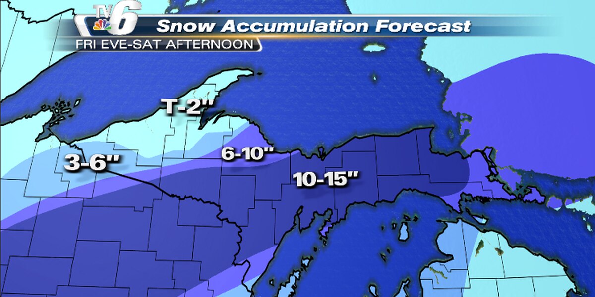
The National Weather Service (NWS) has issued winter alerts for Upper Michigan as a Central Plains system brings moderate to heavy rain, sleet, and snow, along with powerful winds. Snow amounts can range from 10-15 inches in some areas, with winds strengthening to gale force on Saturday. Limited visibility from blowing snow, lakeshore flooding, tree damage, and power outages are all possible before the snow and wind taper off later Saturday. A fast-moving clipper system is expected to bring light to moderate snow over the region through early Monday.
- NWS winter alerts continue Saturday until pummeling snow subsides WLUC
- Another round snow possible Sunday morning with little accumulation, but active weather pattern continues next week WQOW TV News 18
- Justin Liles: Extremely windy tonight, snow to stay south. WDIO
- Let It Snow, Let It Snow, Let It Snow... Again... - ABC 6 News - kaaltv.com ABC 6 News KAAL TV
- Today – A 20 percent chance of snow showers, mostly sunny, with a high near 48 Estes Park Trail-Gazette
Reading Insights
Total Reads
0
Unique Readers
0
Time Saved
1 min
vs 2 min read
Condensed
68%
281 → 89 words
Want the full story? Read the original article
Read on WLUC