"Winter Storm to Blanket Lower Michigan with Accumulating Snow and Freezing Rain"
TL;DR Summary
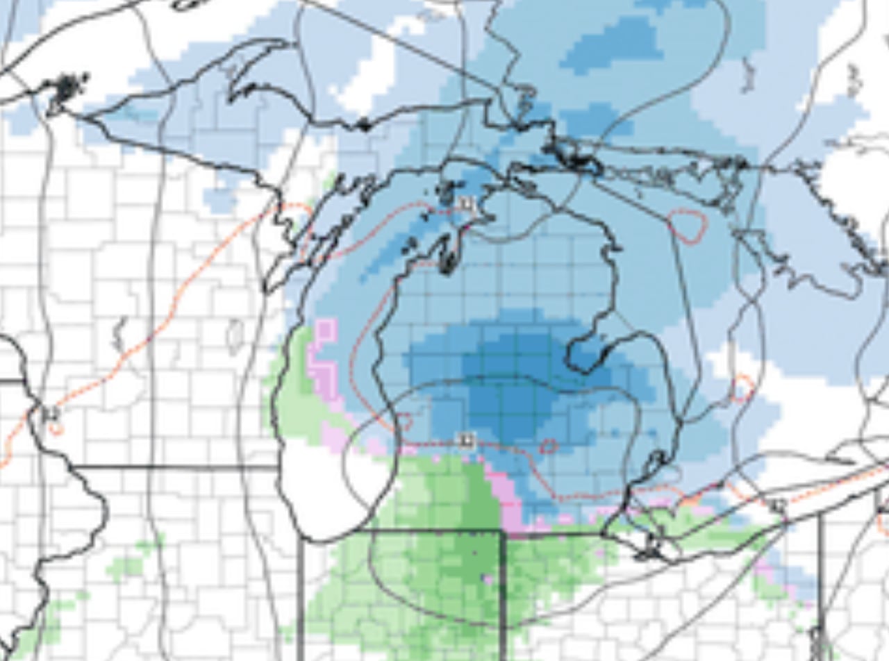
A storm system is expected to bring a swath of accumulating snow to central and northern Lower Michigan on Thursday, with snowfall rates potentially reaching one inch per hour for a few hours. The heaviest snow is forecasted to fall in a stripe from Grand Rapids to Flint/Saginaw and northward to Cadillac and Houghton Lake, with 3 to 5 inches expected in the heaviest swath. There may be a sharp change in snowfall amounts as the snow could change to rain in some areas, causing a sharp cutoff from significant snow accumulation to no accumulation at all in just 10 miles across the southern third of Lower Michigan.
- Meaty snow swath likely in a wide stripe across Lower Michigan MLive.com
- Winter is back this week with an accumulating snow MLive.com
- Snow returns Thursday in SE Michigan: How much and where, maps, storm timeline WDIV ClickOnDetroit
- Metro Detroit Weather: More clouds and a few flurries today WXYZ 7 Action News Detroit
- Accumulating snow, rain, and some light freezing rain likely on Thursday FOX 17 West Michigan News
Reading Insights
Total Reads
0
Unique Readers
1
Time Saved
2 min
vs 3 min read
Condensed
75%
432 → 108 words
Want the full story? Read the original article
Read on MLive.com