Weather Alert: Rain to Sleet to Snow Transition Expected Sunday
TL;DR Summary
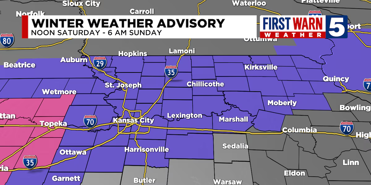
A First Warn is in place from 12 p.m. today until 6 a.m. on Sunday due to rain changing to sleet and then snow, with an expected accumulation of 1-4 inches for areas north of I-70. A Winter Weather Advisory is also in effect during this time. The snowfall is expected to be heaviest between 5 p.m. and 3 a.m., with some areas potentially receiving more than 4 inches. Freezing temperatures overnight will cause wet surfaces to refreeze, leading to hazardous road conditions. Sunday will remain cold and cloudy before clearing up later in the day, and temperatures for the upcoming week are expected to be below average.
Topics:nation#first-warn#freezing-temperatures#roadway-conditions#snowfall#weather#winter-weather-advisory
Reading Insights
Total Reads
0
Unique Readers
0
Time Saved
0 min
vs 1 min read
Condensed
41%
183 → 108 words
Want the full story? Read the original article
Read on KCTV 5