Twin Cities Faces Extreme Heat and Severe Storm Threats This Weekend
TL;DR Summary
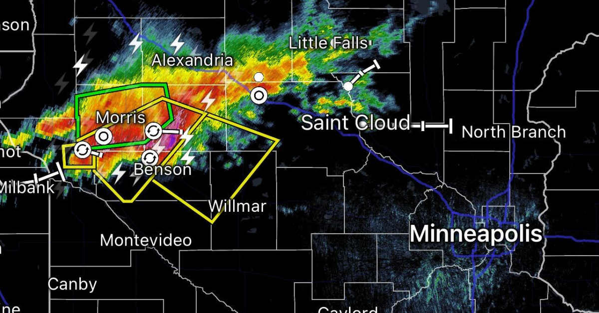
A severe thunderstorm watch is in effect until midnight for the Twin Cities and surrounding areas, with storms capable of producing 70 mph winds, tornadoes, and large hail, as they move east-southeast at around 50 mph, prompting residents to stay alert as the weather develops.
- Severe thunderstorm watch: Storms explode, will they rip through Twin Cities? Bring Me The News
- FORECAST FIRST ALERT FOR TWIN CITIES FOR +100 DEGREE HEAT INDEX TODAY AND STRONG T-STORMS TONIGHT. 5 EYEWITNESS NEWS
- Steamy stretch with rounds of strong storms Sunday and Monday MPR News
- Severe Storm Risk Overnight, Dangerous Heat Monday National Weather Service (.gov)
- First Alert Day: Today & Monday KTTC
Reading Insights
Total Reads
0
Unique Readers
2
Time Saved
1 min
vs 2 min read
Condensed
85%
306 → 45 words
Want the full story? Read the original article
Read on Bring Me The News