Severe Storms Threaten Upper Peninsula, Minnesota, and Wisconsin
TL;DR Summary
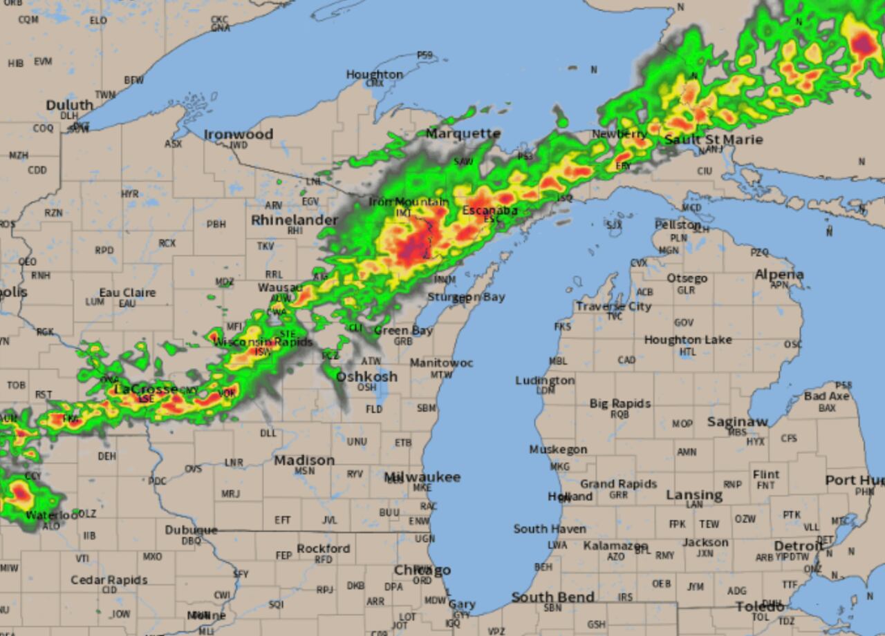
A line of severe thunderstorms is expected to develop across the Upper Peninsula this evening, bringing damaging winds and large hail. The storms will develop in the early evening and move southeast, reaching peak strength around 8 p.m. or 9 p.m. Some areas may experience severe wind gusts over 58 mph, with Iron Mountain, Escanaba, and Naubinway at the highest risk. The storms are expected to weaken as they move towards Traverse City and northwest Lower Michigan, potentially dissipating before reaching Traverse City.
- Line of severe storms expected to develop, bring damaging winds, large hail to Upper Peninsula MLive.com
- Storms could 'pulse up' and turn severe Monday in Minnesota Bring Me The News
- Chance of severe thunderstorms forecast Monday for Appleton, Wausau and Green Bay Post-Crescent
- Hot Monday; late, severe storms possible south; cooler Tuesday statewide MPR News
- Hot and dry today, storms possible tonight | News | wkow.com WKOW
Reading Insights
Total Reads
0
Unique Readers
8
Time Saved
1 min
vs 2 min read
Condensed
76%
346 → 83 words
Want the full story? Read the original article
Read on MLive.com