"Severe Storms and Snow: Weather Alert for Middle Tennessee and Kentucky"
TL;DR Summary
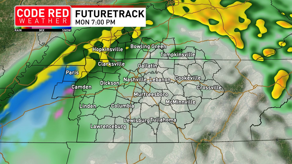
Middle Tennessee and southern Kentucky are under a Code Red Weather alert for thunderstorms and a potential snowfall before midnight, with morning temperatures in the 50s and the possibility of strong storms in the Southern Tier counties. Scattered showers and weaker storms are expected throughout the region, with rain strengthening into the afternoon and high temperatures near 60 degrees before a blast of cooler air brings the potential for snow. A Winter Weather Advisory is in effect for southern Kentucky, with little accumulation expected due to warm surface air and road temperatures.
- CODE RED: Thunderstorms, possible snow on radar in Middle Tennessee, southern Kentucky WZTV
- Will it snow in Nashville? How much is expected in Middle Tennessee Tennessean
- FIRST ALERT WEATHER DAY: Rain and storms, snow overnight WSMV 4
- Rain and a few storms today, snow showers tonight (2.12.24) News Channel 5 Nashville
- Rain, strong to severe storms, then possibly snow in 24 hours Local 3 News
Reading Insights
Total Reads
0
Unique Readers
1
Time Saved
1 min
vs 2 min read
Condensed
55%
204 → 92 words
Want the full story? Read the original article
Read on WZTV