Raleigh-Area Braces for Monday Severe Weather: Tornado Risk and Damaging Winds
TL;DR Summary
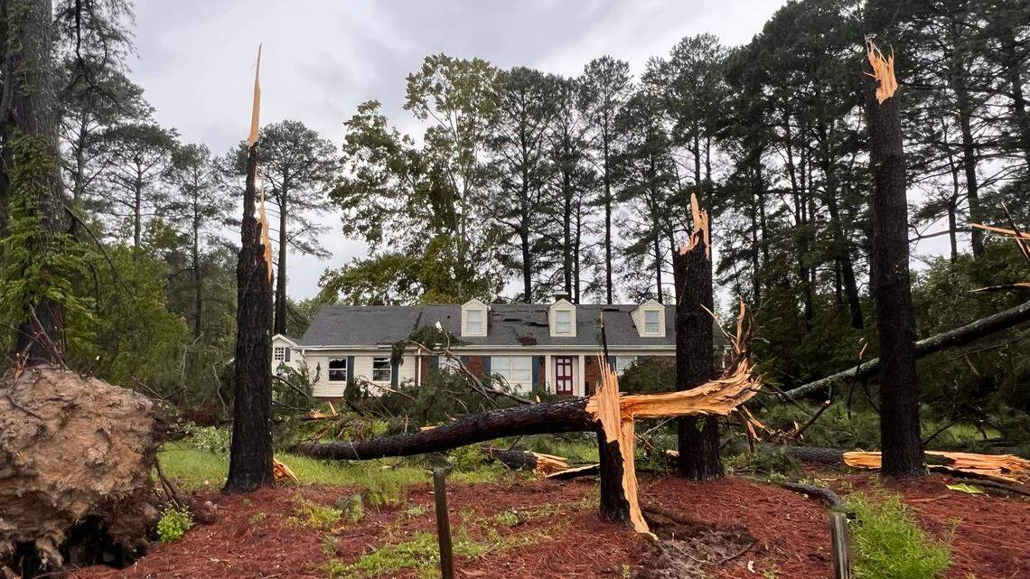
The National Weather Service issued a level 3 enhanced risk for Monday as the Triangle and much of North Carolina could see scattered storms during late morning to early afternoon, followed by a squall line capable of damaging winds and isolated tornadoes. Expect 0.5–1 inch of rain and winds around 30–35 mph even outside storms. The alert comes after five tornadoes hit eastern NC on Thursday, underscoring ongoing risk and the need for warning access.
- Tornadoes and strong winds possible in the Triangle. When will severe weather hit? News & Observer
- Rare Level 4 risk of severe weather issued Monday; widespread severe storms possible WRAL
- CWG Live: In the 50s today, with a sprinkle? Strong to severe storms possible tomorrow. The Washington Post
- Impact Day: Isolated severe storms possible this afternoon Gulf Coast News and Weather
- StormTracker8: Mild Sunday; VIPIR Alert Monday for Severe Storms WRIC ABC 8News
Reading Insights
Total Reads
0
Unique Readers
2
Time Saved
3 min
vs 4 min read
Condensed
90%
760 → 75 words
Want the full story? Read the original article
Read on News & Observer