Midweek Storms and Heatwave Expected in Metro Detroit
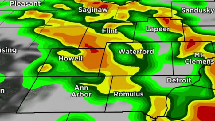
Metro Detroit can expect active weather with high temperatures in the upper 80s on Wednesday and lower 90s on Thursday. There will be cloud cover and a few showers leading up to the active weather. The region will be on the edge of an upper-level ridge of high pressure, bringing extreme heat to parts of the Lower Ohio Valley and Southwestern Michigan. Heat advisories and excessive heat watches are already in effect. There will be multiple rounds of showers and thunderstorms, with a marginal risk for severe weather on Wednesday. Heavy rainfall is the primary threat, but damaging winds, large hail, and isolated tornadoes are also possible. The active pattern will end by the end of the week, bringing back sunshine with cooler temperatures in the 70s.
- Active weather to kick in midweek in Metro Detroit -- here's what to expect WDIV ClickOnDetroit
- Tracking spotty showers Tuesday, storms Wednesday in Metro Detroit Click On Detroit | Local 4 | WDIV
- Detroit weather: Getting hotter with storms today - Forecast WXYZ 7 Action News Detroit
- 5-day stint of severe thunderstorms possible for Michigan MLive.com
- Heat, humidity and storms move into southeast Michigan midweek CBS News
- View Full Coverage on Google News
Reading Insights
0
0
2 min
vs 3 min read
75%
510 → 127 words
Want the full story? Read the original article
Read on WDIV ClickOnDetroit