Metro Detroit Snow Forecast: 48-Hour Timeline and Accumulation
TL;DR Summary
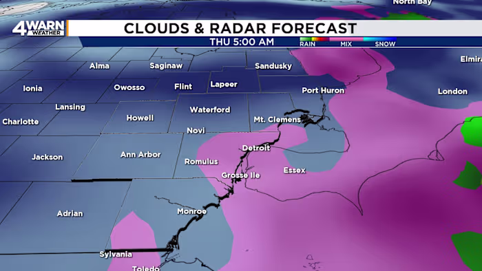
A winter storm is expected to bring snow to Southeast Michigan over the next 48 hours, with the heaviest snowfall likely occurring from Wednesday night into Thursday morning. Snow flurries may begin early Wednesday, with light accumulation possible in the Thumb region. Snow chances increase Wednesday afternoon, potentially mixing with rain, leading to a wet snow event. The heaviest snow is expected overnight Wednesday into Thursday, with 1-2 inches of accumulation and strong winds causing blowing snow and reduced visibility. Temperatures will feel significantly colder due to wind chills.
Reading Insights
Total Reads
0
Unique Readers
0
Time Saved
2 min
vs 3 min read
Condensed
80%
453 → 89 words
Want the full story? Read the original article
Read on WDIV ClickOnDetroit