Heavy Rain Arrives Early in Friday Storm Update
TL;DR Summary
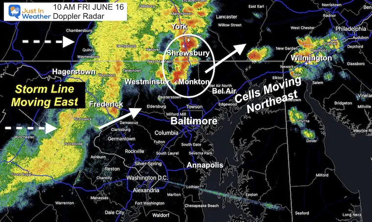
The rain has arrived earlier and heavier than expected in areas north and west of Baltimore, with more pop-up storms expected in the afternoon. There is a risk for some of these cells to turn severe, including flash flooding, damaging winds, large hail, or even a tornado. Thunderstorms will move through metro areas around lunchtime, then build stronger in the afternoon heat as they travel east. The Slight Risk is higher for individual cells to turn severe, including Annapolis and across the Bay to Delmarva. The rainy pattern for next week looks less impressive, but the unsettled weather looks to remain in the Southeast US.
Reading Insights
Total Reads
0
Unique Readers
5
Time Saved
5 min
vs 6 min read
Condensed
90%
1,017 → 105 words
Want the full story? Read the original article
Read on Just In Weather