Beware of Strong Winds: Latest Weather Updates
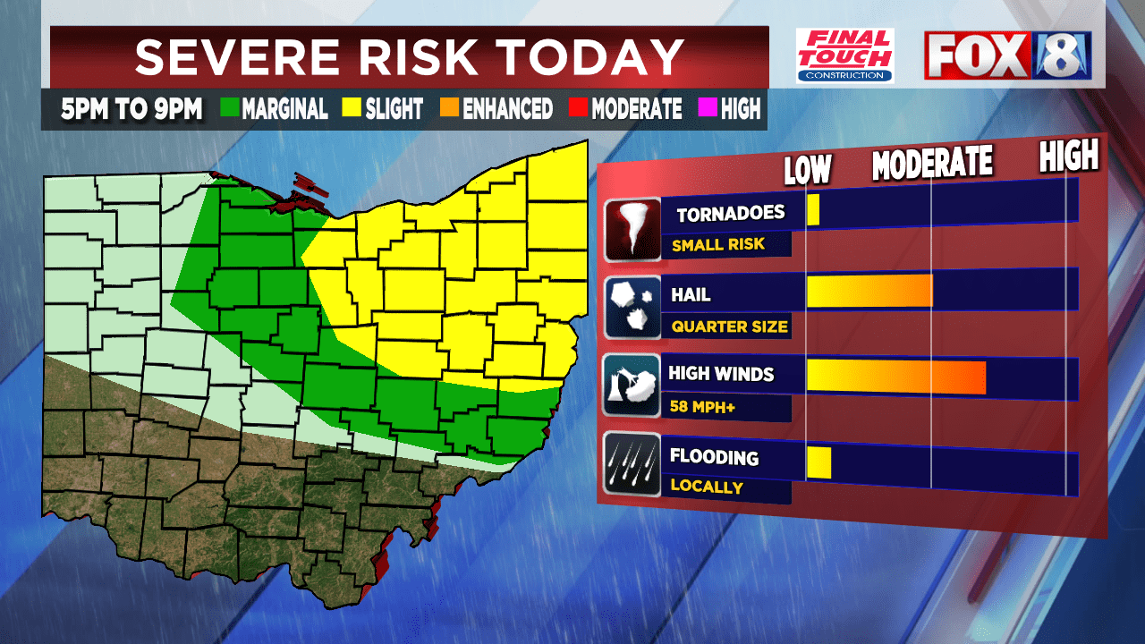
A line of severe thunderstorms with 60 MPH winds and pea-size hail is active in western counties of Northeast Ohio until 11:45 a.m. A wind advisory has been issued for Northeast Ohio today from 8 a.m. to 4 p.m. with gusts of 50 mph or above. Another round of showers and severe storms is anticipated this afternoon with a severe threat between noon and 4 p.m. Snow is back in the forecast as a mix of precipitation is expected after the cold front moves through. The Storm Prediction Center has issued a marginal/slight for mainly eastern counties with scattered strong to severe supercell thunderstorms possible. Sunday is the quiet day of the weekend, but a warm-up is expected next week.
- Wind advisories: What you need to know WJW FOX 8 News Cleveland
- High Wind Warning issued: Power outages up to 12K across Tri-State FOX19
- FORECAST: Gusty winds and falling temperatures for Saturday WAVE 3
- FIRST ALERT WEATHER DAY: Storm threat ends, but high wind threat continues WYMT
- Columbus Weather: Storms roll through Central Ohio early Saturday morning ABC6OnYourSide.com
Reading Insights
0
0
1 min
vs 2 min read
57%
277 → 120 words
Want the full story? Read the original article
Read on WJW FOX 8 News Cleveland