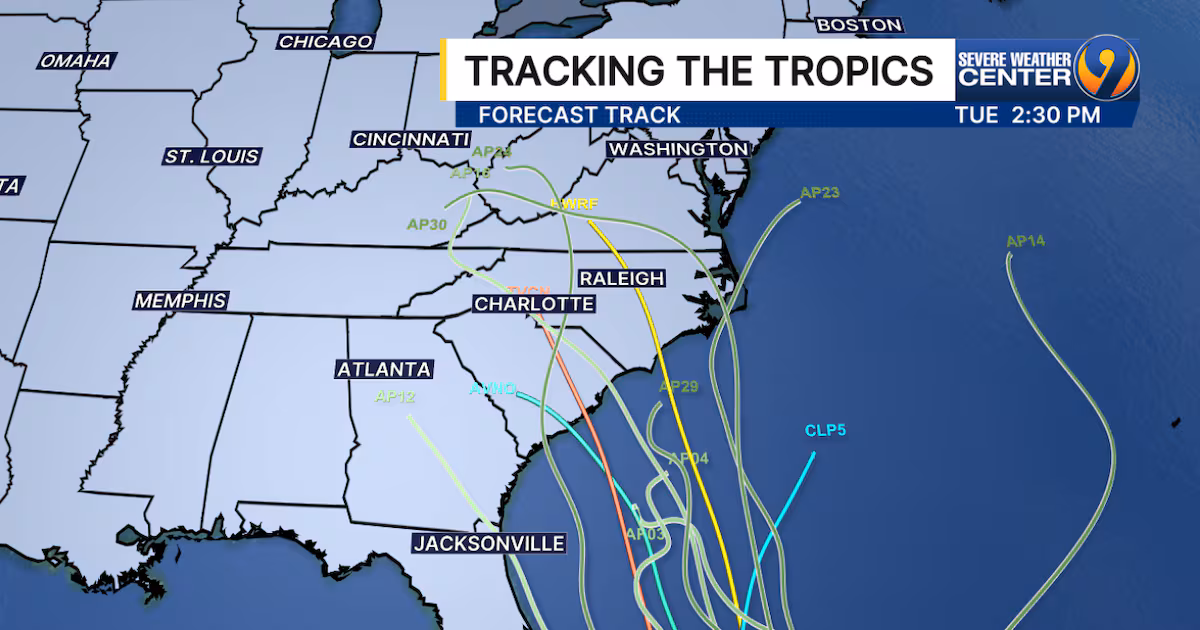
A developing tropical wave, Invest 94L, is strengthening near Hispaniola and may impact the Carolinas early next week with heavy rain, gusty winds, and severe weather, with potential landfall between Georgia and the Outer Banks, according to recent model guidance.
Tropical Disturbance Invest 94L, currently a large area of low pressure with disorganized thunderstorms, is expected to develop into at least a tropical depression this week as it moves towards the northeastern Caribbean islands. The strength of the system will determine its track, with a weaker system more likely to directly affect the islands and a stronger system potentially turning north. The latest computer forecasts favor a weaker system, but confidence in any one forecast is low until an organized system forms. There is no threat to the U.S. or surrounding areas, as a cold front will block any westward path. Tropical Depression Sean is dissipating in the central Atlantic, while a broad area of low pressure over Central America is expected to gain strength in the coming weeks.