Houston Braces for Arctic Front: Rain Saturday, Frost Sunday
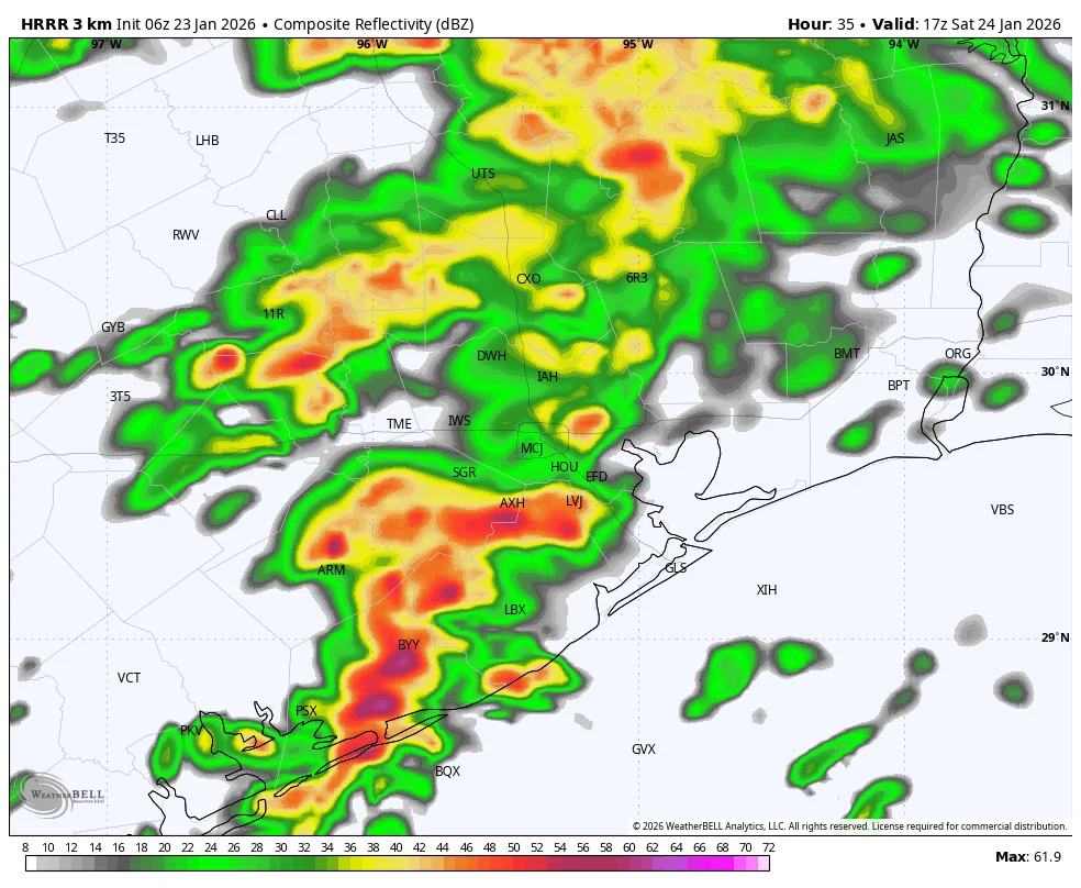
Space City Weather warns of an approaching Arctic front for the Houston area: expected Friday fog and mild highs, a chance of light showers, then a Saturday mid‑morning thunderstorm risk with around 0.5–1 inch of rain as a warm, moist air mass meets cooler air. Temperatures drop late Saturday into Sunday, with possible freezing temperatures and up to about 0.2 inch of ice accumulation in Montgomery County and parts northwest of Houston; roads may be icy on Sunday morning depending on surface temps. Sunday afternoon should see clearing but very cold conditions (20s–30s in urban Houston) with a dry Sunday night and a cold Monday (35–40 F). A gradual warm‑up is expected next week, though another Arctic push and even a slim snow chance are possible later in the week, per model variability.