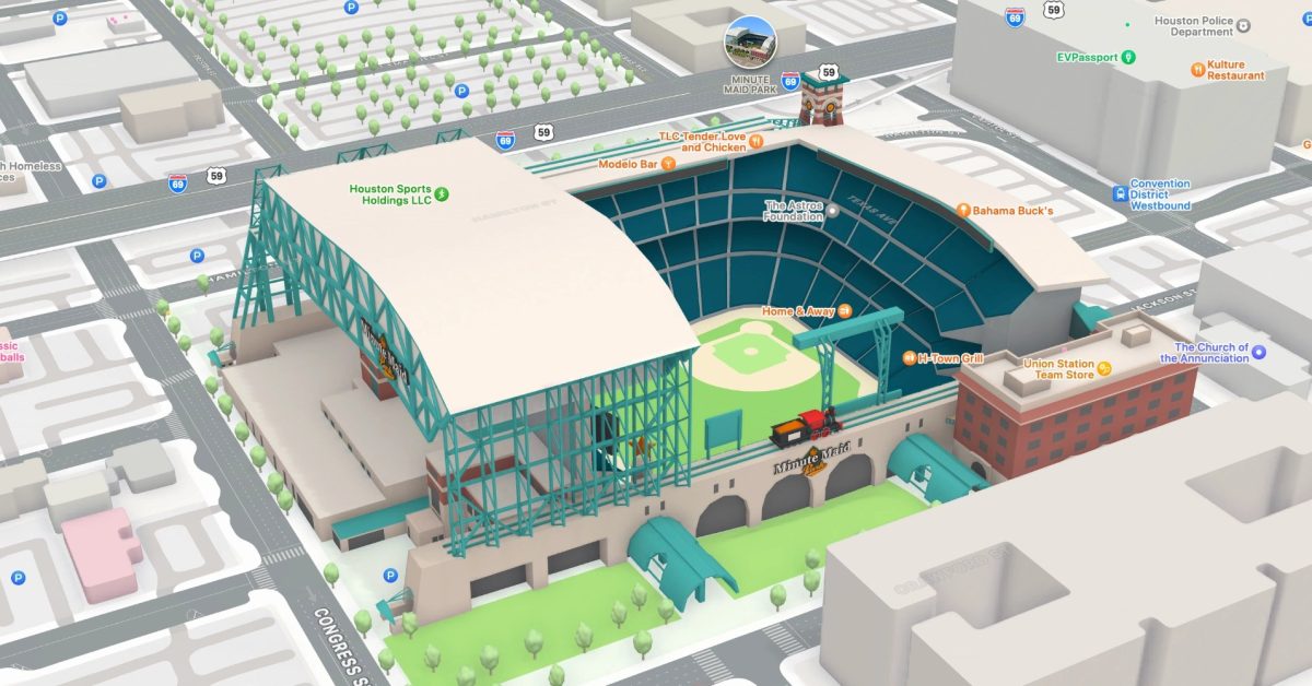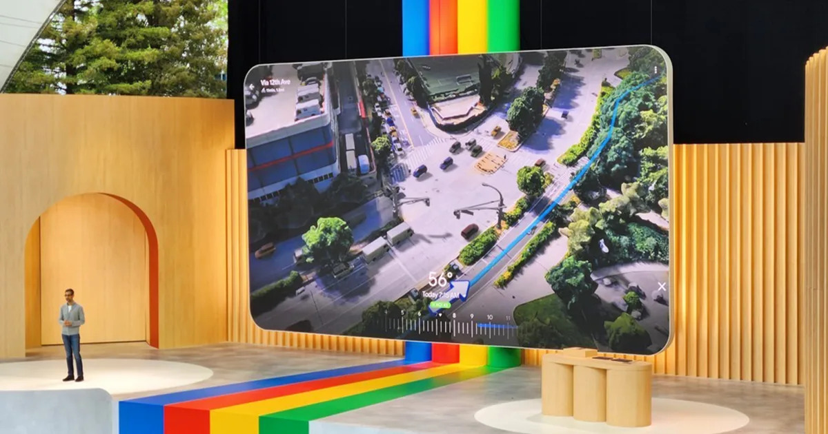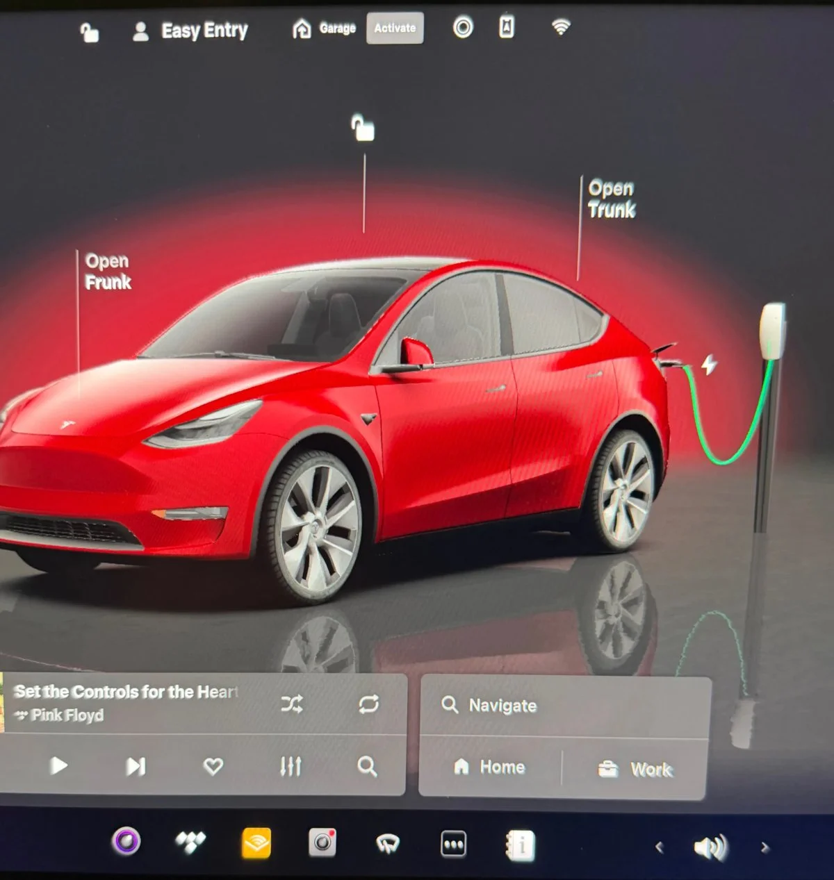
Tesla 2025.38 Update Enhances Navigation, Media, and Safety Features
Tesla's 2025.38 update introduces major visual and functional enhancements including 3D buildings in navigation, expanded Grok AI assistant in Canada, improved Dashcam features, profile locking, and new charging visualizations, with ongoing rollout and upcoming FSD V14.1 features for the Cybertruck.