Texas Flooding: Rising Death Toll and Flood Risks Revealed by FEMA Maps
TL;DR Summary
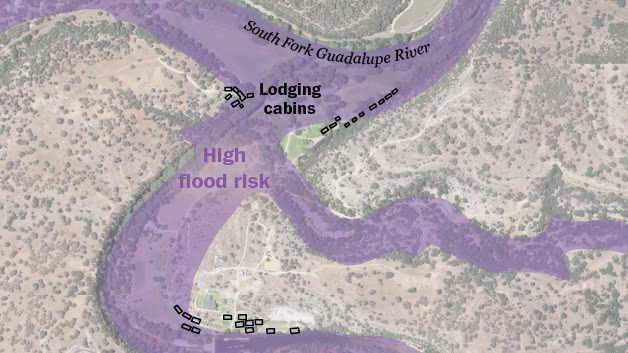
FEMA flood risk maps reveal that over a dozen summer camps along the Guadalupe River in Kerr County, Texas, are located in high-risk flood zones, highlighting potential dangers of severe flooding in the area.
- See how FEMA maps reveal camps’ flood risks The Washington Post
- Texas flooding: At least 104 people dead, 10 girls still missing FOX 7 Austin
- Death toll in Texas flooding surpasses 100 as search and rescue enters 5th day CNN
- Why did the Guadalupe River flood so fast? What to know about Texas' 'Flash Flood Alley' Austin American-Statesman
- My friend, Dick Eastland: Locals mourn loss of Camp Mystic’s longtime owner and director dailytimes.com
Reading Insights
Total Reads
0
Unique Readers
8
Time Saved
0 min
vs 1 min read
Condensed
66%
99 → 34 words
Want the full story? Read the original article
Read on The Washington Post