Tri-State braces for weekend snow as timeline shows peak accumulation
TL;DR Summary
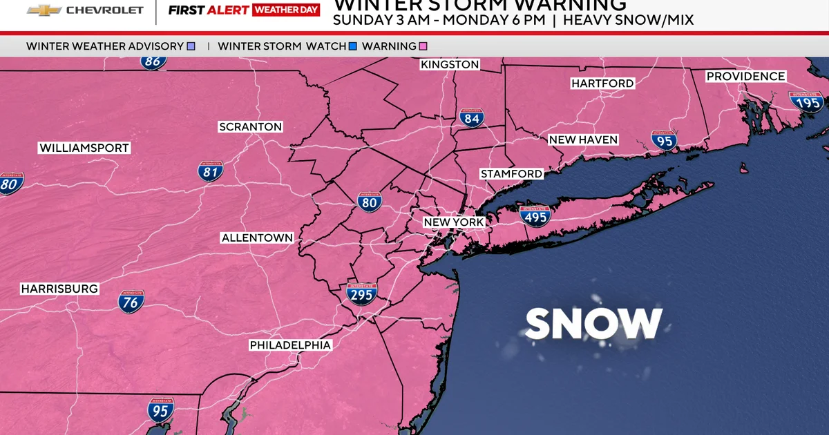
A major winter storm is headed for New York and New Jersey this weekend, triggering winter storm warnings and a state of emergency as Gov. Hochul activates the National Guard. The Tri-State area could see NYC 8–12 inches, North Jersey 12 inches or more, and coastal areas 5–10 inches, with inland zones possibly over 12 inches. Snow moves in Sunday morning (3–7 a.m.), intensifies 7 a.m.–2 p.m., then mixes with freezing rain/sleet 2–10 p.m. as warmer air moves in, before returning to snow Sunday night into Monday with winds 25–35 mph and up to 0.20 inches of ice accretion.
- Winter storm timeline for New York, New Jersey shows when heaviest snow will hit this weekend CBS News
- Good old-fashioned snow day may be healthy for kids, doctors say: 'Permission to unplug' Fox News
- Live updates: Latest snow map shows higher totals in parts of NY; NJ seeing mix nbcnewyork.com
- Mamdani roasted for ‘idiotic and moronic’ warning on NYC snowstorm Yahoo
- Zohran Mamdani’s first NYC snowstorm becomes a major governing test CNN
Reading Insights
Total Reads
1
Unique Readers
19
Time Saved
3 min
vs 4 min read
Condensed
85%
670 → 99 words
Want the full story? Read the original article
Read on CBS News