"Deadly Storm Devastates Houston: Infrared Maps, Dashcam Footage, and Power Outages"
TL;DR Summary
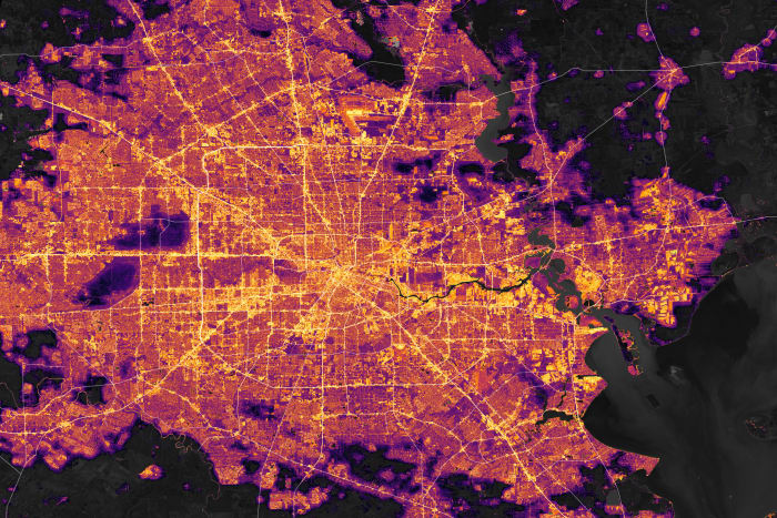
An interactive infrared map from NASA Earth Observatory reveals the dramatic impact of a deadly derecho on Houston, showing widespread power outages and damage. The map, based on data from the VIIRS sensor on the NASA-NOAA Suomi NPP satellite, highlights the intensity of the storm that shattered 4,000 windows, toppled trees, and left nearly 1 million homes and businesses without power, resulting in at least eight fatalities.
- Eerie: Infrared map shows Houston before and after deadly derecho KPRC Click2Houston
- Dashcam video shows deadly storm blasting through downtown, shifting car and blowing out windows KTRK-TV
- PHOTOS: Buildings destroyed, debris scattered after tornado hits Bell County, Temple KXAN.com
- Downtown Houston will not look normal for months after rare storm Houston Chronicle
- Houston power outages: CenterPoint gives Wednesday update | khou.com KHOU.com
Reading Insights
Total Reads
0
Unique Readers
1
Time Saved
1 min
vs 2 min read
Condensed
81%
356 → 67 words
Want the full story? Read the original article
Read on KPRC Click2Houston