"AI and Satellite Data Unveil the Hidden Congestion and Illegal Activities of Ocean Vessels"
TL;DR Summary
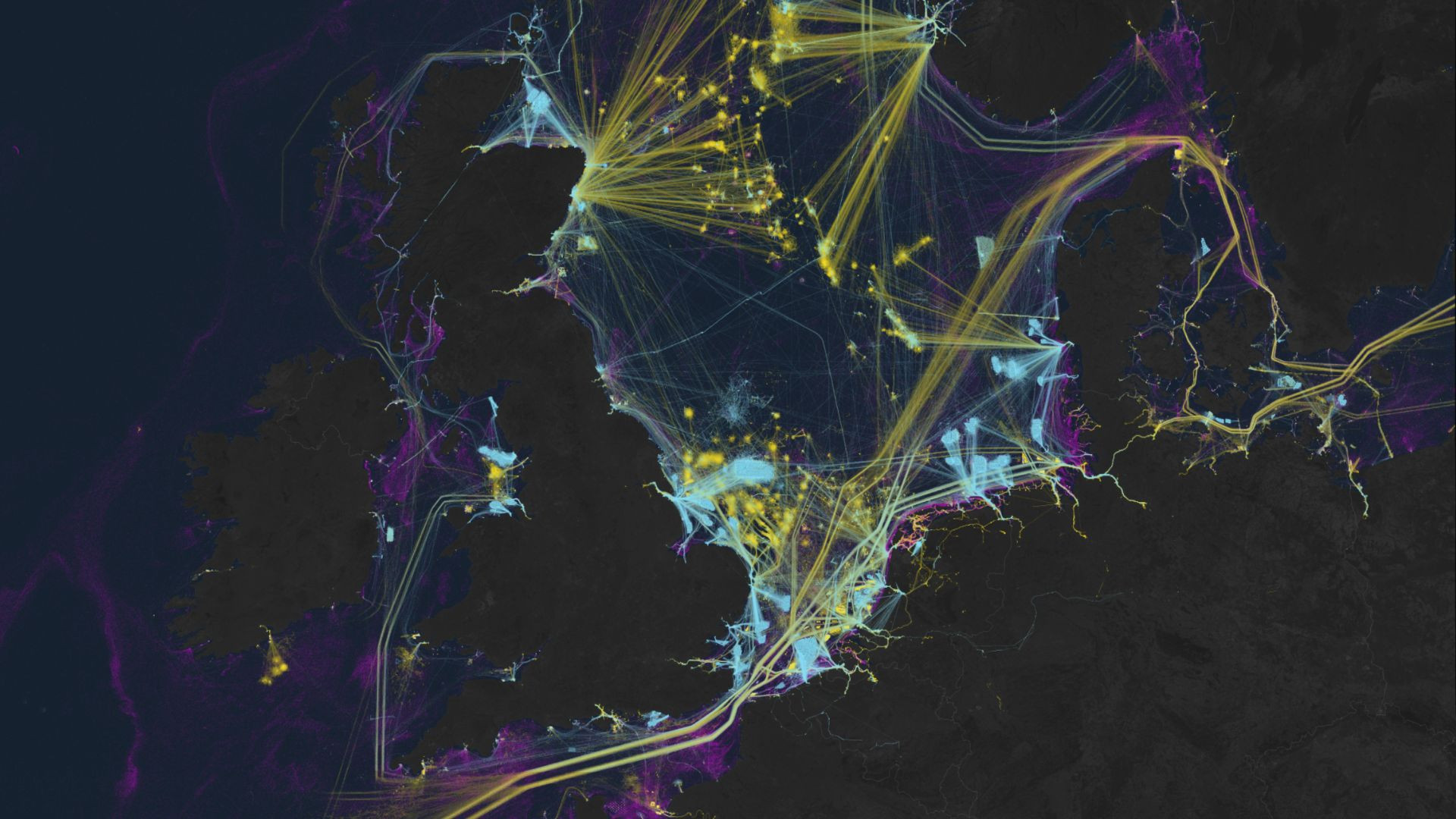
A new study utilizing satellite imagery has revealed extensive illegal fishing activities by the 'Ghost Fleet,' which accounts for 75% of the fish industry's unmonitored and unregulated operations. This breakthrough in mapping industrial activities at sea from 2017 to 2021 highlights the challenges in tracking maritime activities due to limited vessel-tracking systems and the lack of mandatory tracking devices on all vessels. The findings are significant given the ocean's vital role in global trade, food supply for over a billion people, and employment for 260 million in the marine fisheries sector.
Topics:business##environment-and-technology#ghostfleet#globalfisheries#illegalfishing#marineconservation#satelliteimagery
- AI, satellites expose 75% of fish industry's 'Ghost Fleet' looting seas Interesting Engineering
- Satellite mapping reveals extensive industrial activity at sea Nature.com
- New Mapping Finds the Oceans Are Filled With "Dark Vessels" Futurism
- How crowded are the oceans? New maps show what flew under the radar until now The Verge
- We used AI and satellite imagery to map ocean activities that take place out of sight, including fishing, shipping and energy development The Conversation
Reading Insights
Total Reads
0
Unique Readers
11
Time Saved
0 min
vs 1 min read
Condensed
37%
144 → 91 words
Want the full story? Read the original article
Read on Interesting Engineering