Typhoon Mawar Threatens Guam with Destructive Force.
TL;DR Summary
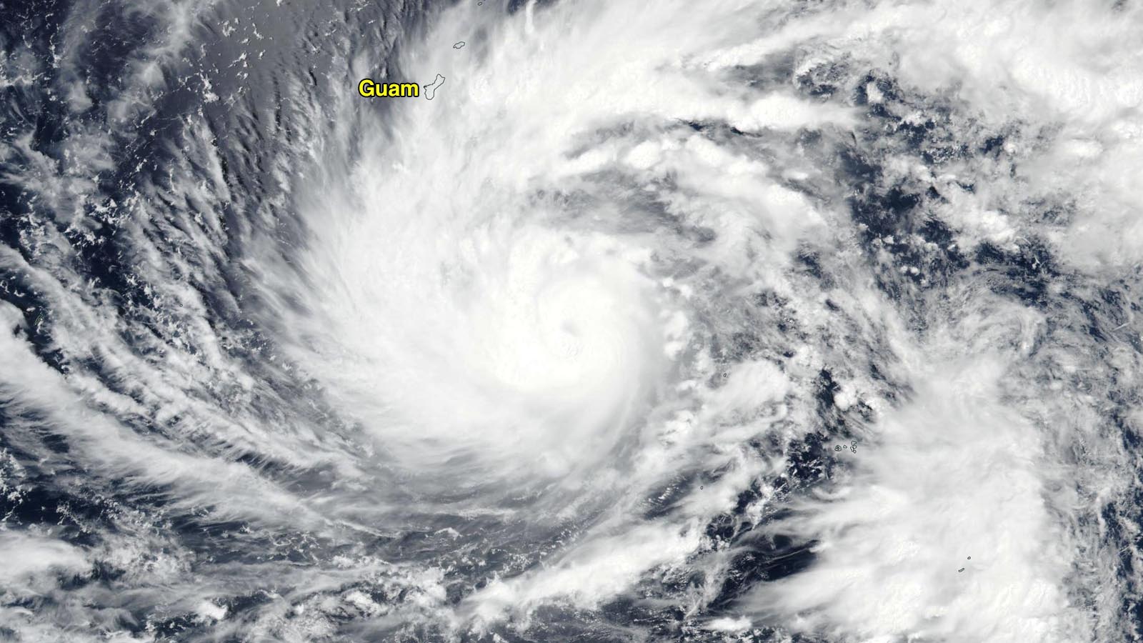
Typhoon Mawar is expected to make landfall on Guam and the Northern Mariana Islands on Wednesday local time, bringing sustained winds of 120 mph, gusting to 140 mph, a storm surge of four to six feet, torrential rains of eight to 15 inches, and dangerous high surf of 15-25 feet. Mawar has favorable conditions for intensification and is predicted to intensify to a category 3 typhoon with 120 mph winds by the time it reaches Guam, with continued intensification to a category 4 storm with 145 mph winds by Friday. Tropical Storm Risk predicts an above-average typhoon season.
Topics:world#guam#intensification#natural-disasters#northern-mariana-islands#tropical-storm-risk#typhoon-mawar
- Guam braces for Typhoon Mawar » Yale Climate Connections Yale Climate Connections
- Typhoon Mawar Heads Toward Guam The New York Times
- Typhoon Mawar Could Be Guam's Strongest In 20 Years With Destructive Storm Surge, Winds, Flooding Rain The Weather Channel
- Guam braces for ‘extensive damage’ from Typhoon Mawar Hawaii News Now
- Weather tracker: Guam and Philippines brace for Typhoon Mawar The Guardian
- View Full Coverage on Google News
Reading Insights
Total Reads
0
Unique Readers
2
Time Saved
6 min
vs 7 min read
Condensed
92%
1,204 → 98 words
Want the full story? Read the original article
Read on Yale Climate Connections